Mona Vale to Avalon
This coastal trail begins at Mona Vale Beach and heads north dipping onto several beaches en route to Avalon.
The trail is point to point. You can retrace your steps to get back to the start or take the bus back to Mona Vale.
There is a bit of climbing involved (think views!) and some of the trail meanders through local streets. But for the most part the trail is level and much of the time you’ll be walking beachside or through bushland reserves.
Dogs on leads are ok for parts of the walk but they’re not allowed on most beaches and nature reserves so probably best to leave them at home. (You can find local off-leash areas here.)

Looking back to Newport from North Bilgola Lookout
To Start
There is plenty of parking in Mona Vale both in the beach car park, (ticket or local permit required) or in one of the nearby streets.
If you’re starting out early as we did, you can pick up coffee from 6:30am at the cafe attached to the Surf Life Saving Club. The walk begins from here.
Depending on the time and season, you might want to pack a hat and sunscreen. And with so many beautiful beaches to choose from, swimmers and a towel.
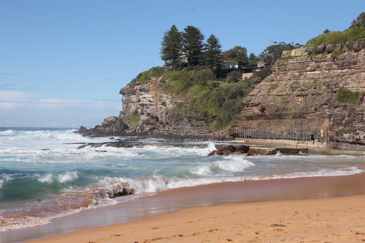
Mona Vale Beach
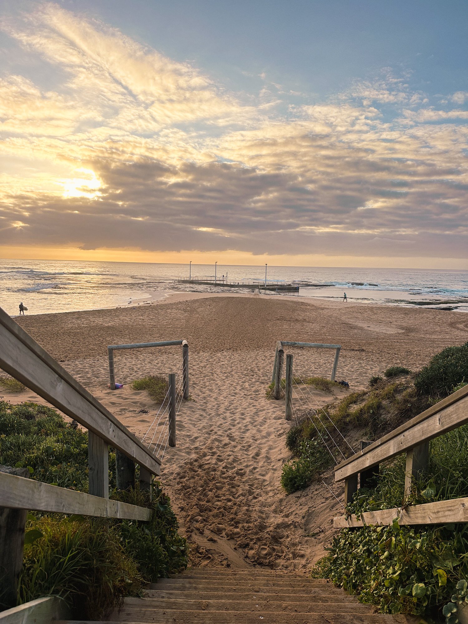
Mona Vale Beach and Ocean Pool


To begin the walk, step down on to the sand, or take the footpath and head north.
Beyond the ocean pool is Basin Beach, a little arc-shaped beach to the left of the main beach. Surfers like this spot for the reef breaks, but if you’re thinking of taking a pre-walk swim, keep in mind that there’s often a dangerous undertow here.
Just up from the end of the beach, is the stairway leading up to Mona Vale Headland. Before heading up, check out some of the interesting rocks at the base of the headland including one one with a face carved into it. I have no idea who did it or how long it’s been there (anyone?), but I’m told it’s not the only face adorning rocks along the northern beaches.


Mona Vale Haedland to Newport
Climb the stairs to the headland that looks out over Mona Vale Beach and up the heads to Long Reef and Manly. This reserve, famed as a bushranger hideout, is also known as Bushranger Hill although there is a call for the headland to be renamed in honour of Bowen Bungaree, a local policeman and tracker.
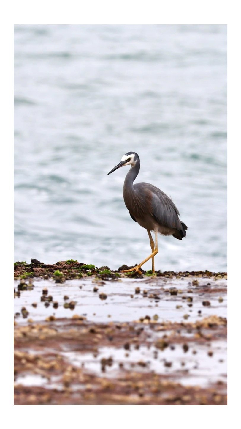
The reserve, is home to many winged creatures including my favourites the busy Willy Wagtail the ever-watchful Nankeen Kestrel, so look out for them.
After leaving the headland reserve, there’s a bit of street walking involved with an optional diversion down to Bungan Beach (see below).
Head down Hillcrest Avenue at the end of which you’ll meet busy Barrenjoey Rd. Take care here as the traffic flies past and the footpath is barely there.


Fortunately, you’re not on this road for long. Turn right at Karloo Parade and continue on to turn right at Bungan Head Road before taking a quick left onto Myola Rd which will take you all the way to Newport Beach.
Local real estate agents refer to this area around Myola Rd as The Golden Triangle. It’s not got the grandest homes in the area, though many are very nice, but it has good sized blocks, and is close to the village and beach. It has some pretty gardens and trees too which attract those noisy, colourful birds you’ll probably hear as you walk.

Bungan Beach
For an extra 2000 steps or so, turn down Beach Rd and walk down into Betty Morrison Reserve and on to Bungan Beach.
This is a pretty little beach and quiet too as you can only really get to it on foot. The beach backs on to some lush native bushland alive with native birds and animals including Long-nosed bandicoots, Peregrine Falcons and Powerful owls.


Newport to Bilgola
Newport Beach is a little over one kilometre long, and is backed by beautiful big Norfolk pines. The beach is popular with surfers and families.
There’s a rock pool at the south end and a fenced playground near the Surf Club. There are cafes nearby if you want to make a stop here, or do as we did and pick up something at Bilgola Beach, or Avalon at the end of the walk. There are plenty of options.


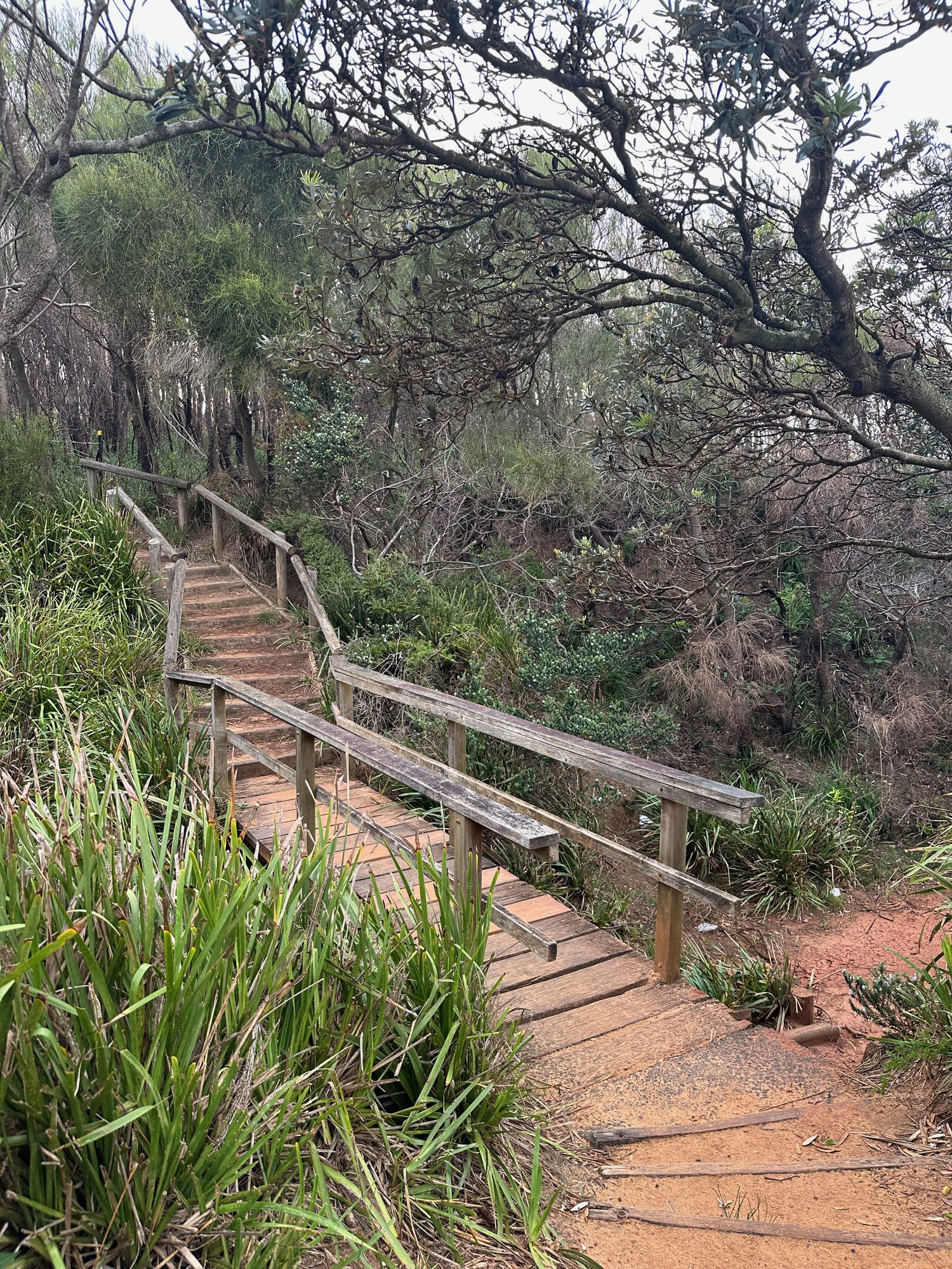
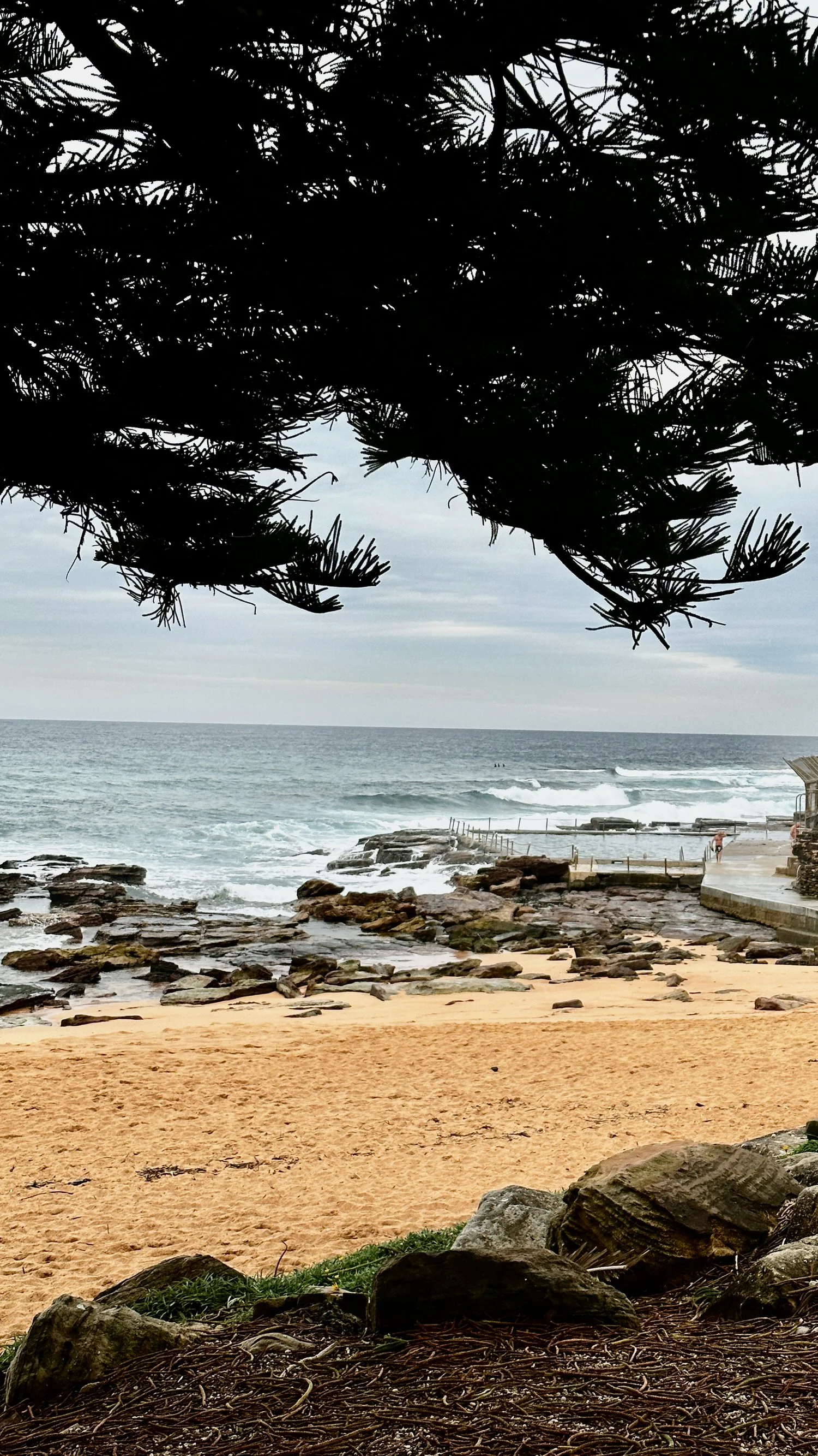
Look for the pathway on the northern edge of the beach car park that leads to the South Bilgola Headland.
At the top of the stairs there’s a pretty boardwalk section that skirts the headland, offering views back down to Newport and soon to Bilgola.
The path continues on, partly shaded by overhanging trees, down to Bilgola Beach
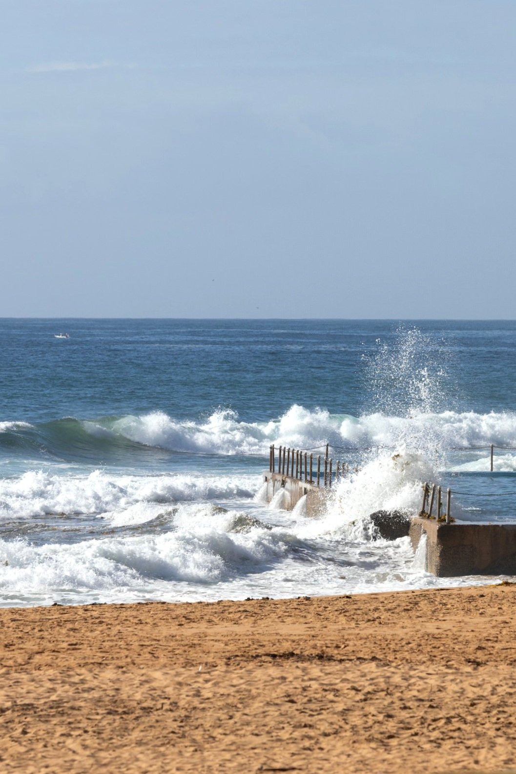


Bilgola Beach has a relaxed, local feel. Its about 500 metres long and has a 50 metre long accessible ocean pool at the south end. There’s a Surf Lifesaving Club, showers, toilets and a popular cafe - Zubi at Billys, just up from the sand
We had a nice breakfast here (just watch out for the birds) before walking to the northern end of the beach to complete the last leg of the journey.
Bilgola to Avalon
At the end of Bilgola Beach is a set of steep stairs which lead to The Serpentine. On your way up the stairs look out for the large Moreton Bay Fig, also known as a strangler fig, with one of its victims, a palm tree, beside it.


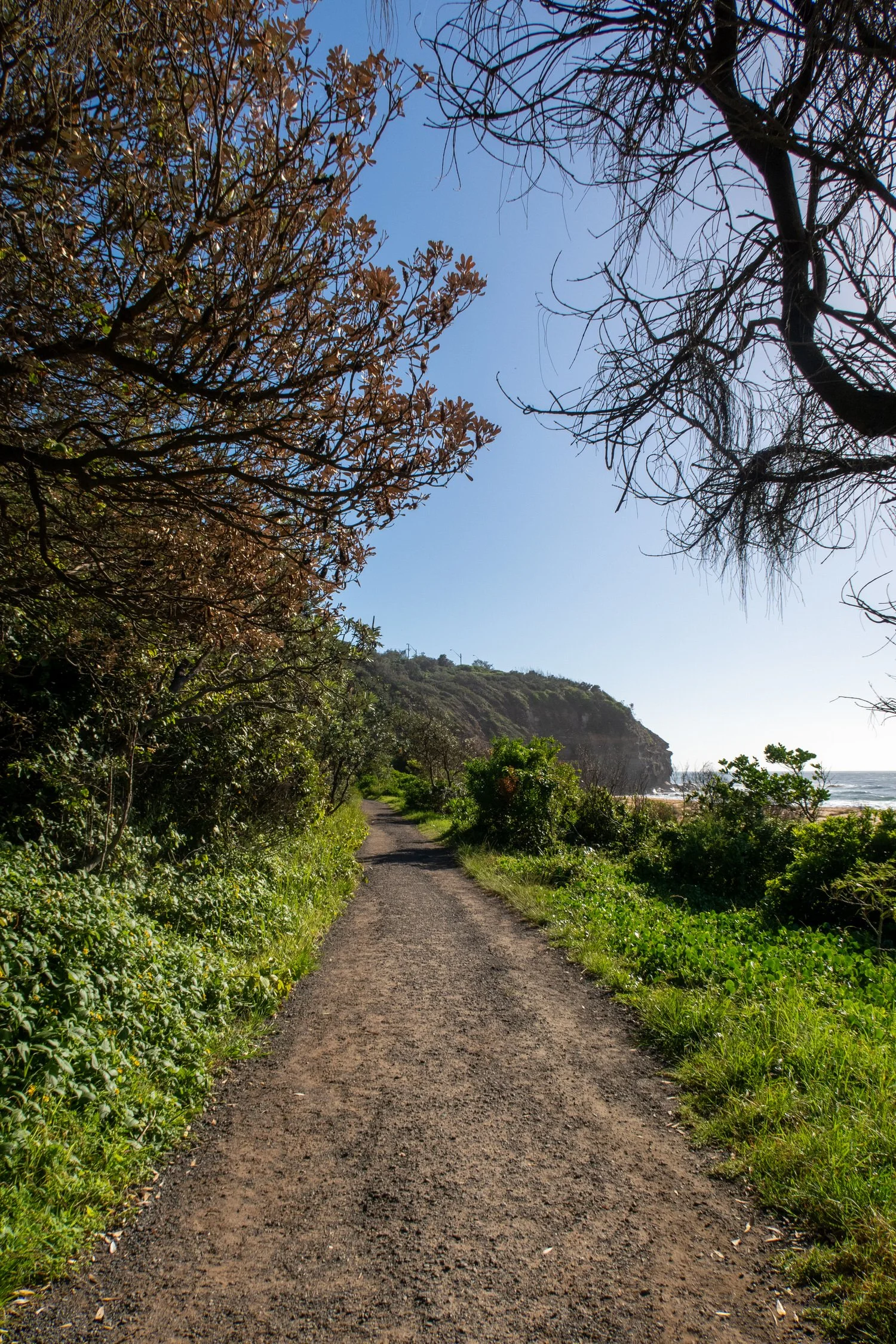
Follow The Serpentine as it winds around North Bilgola Headland. You’ll be walking along this road, (reasonably quiet but no footpaths) for about 500 metres.
There are some great houses along this stretch with pretty coastal gardens and fabulous views. You can get your own taste of these views from North Bilgola Lookout which you’ll see on your left as you round the bend.
Continue on to the end of the The Serpentine where it meets Barrenjoey Road. You’ll have to rejoin that busy main road again, but not for long.
As you get closer to Avalon look out for the turnoff with a sign saying Access to Beach. This pathway will take you to Surfside Avenue which leads down to Avalon Beach.

Avalon
This walk ends at the ocean pool at the southern end of the beach.
Avalon Beach is as good a place as any to take a dip and this end of the beach is probably best as surfers favour the northern end. There are toilets and change rooms at the surf club.
Behind the beach is a skate ramp and basketball court, and there’s a playground in nearby Dunbar Park. There’s a vibrant village on the other side of Barrenjoey Rd where you’ll find many cafes and shops.
The 199 bus will get you back to Mona Vale in around 15 minutes. It won’t take you all the way to the beach though. If you parked at the beach you’ll need to get off at the the stop near Seabeach Avenue and walk around 500m back to the car park.
In the area
This walk begins where the North Narabeen to Mona Vale walk ends and the Avalon to Palm Beach walk begins. If you’re feeling energetic you could tack either one on to this trail for a much longer walk. .
If you fancy a long lunch or lazy afternoon in a waterside beer garden, the 199 bus goes past the old Newport Arms, now The Newport. Or take a twenty minute ride on the 191 bus to Clareville, a pretty little protected beach on Pittwater. The water is calm, great for kids and there’s plenty of shade. Facing west, it’s also a nice spot to watch the sunset.

