Avalon to Palm Beach
The walk from Avalon to Palm Beach traces a mostly coastal path overlooking the ocean. There is a little bit of climbing involved but that’s how you get the views. There’s also a bit of street walking in sections but there’s plenty to see here too.
The walk can be done in either direction and conveniently, the 199 bus gets you back to the start. If you want to walk little further, add the Barrenjoey Headland Walk or start at the Palm Beach end and continue past Avalon along the many Northern Beaches that stretch all the way to Manly.
After rain, parts of the trail can be quite slippery so hiking shoes will be your best bet. There’s very little shade to be had so a hat and sunscreen are also recommended. And as you’ll be taking in three beautiful beaches, swimmers and a towel are advised. But no dogs.

To Start
The walk starts at Avalon Beach. You can get to Avalon by catching the B-line and 190 or 199 bus, but the trip is over an hour.
The main parking area at the beach requires a paid ticket or local permit but you can usually find a free spot on one of the nearby streets.
Head down to the sand or take the parallel pathway and make your way towards Avalon Headland.
Avalon
Avalon is a favourite seaside postcode for the well-heeled and a popular area to visit The village of Avalon has many cafes and shops and the area behind the beach has a playground, skate ramp and basketball court.
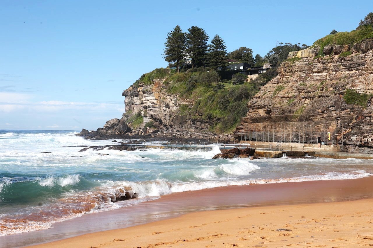
There is an ocean pool at the southern end of the beach with a toddler wading pool beside it. Surfers tend to gather at the Northern end of the beach, known for good surfing breaks. Head that way.


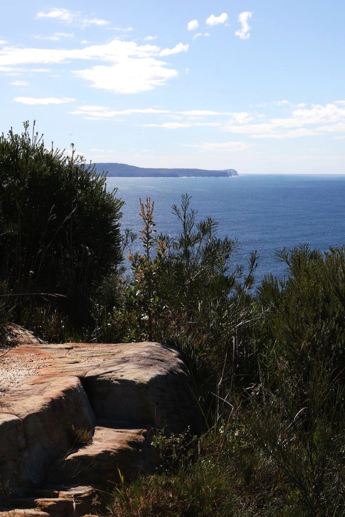
To Bangalley Headland
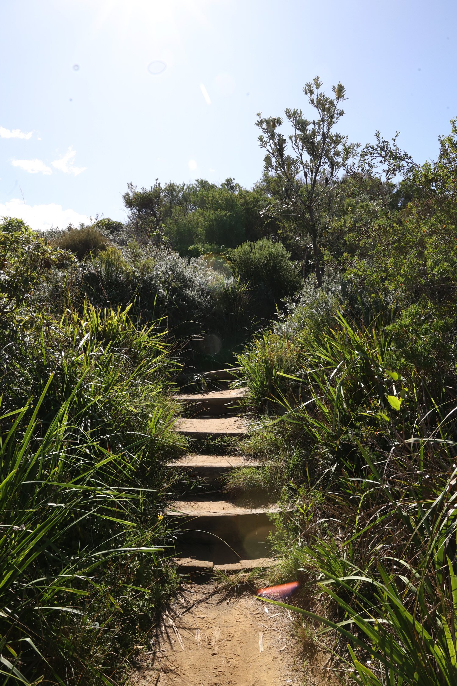
A path at the end of Avalon Beach will take you up to Marine Parade. Follow this for a couple of blocks before following the sign to Bangalley Headland.
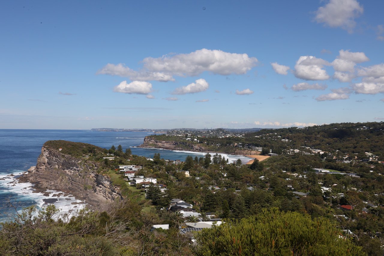

Bangalley Head is one of the Northern Beaches largest bushland reserves and at 116 metres above sea level, its highest point.
This means there’s a bit of climbing needed to get to the peak. But the views, all the way to the city looking south, and over to Broken Bay and the Central Coast to the north, are well worth the effort.
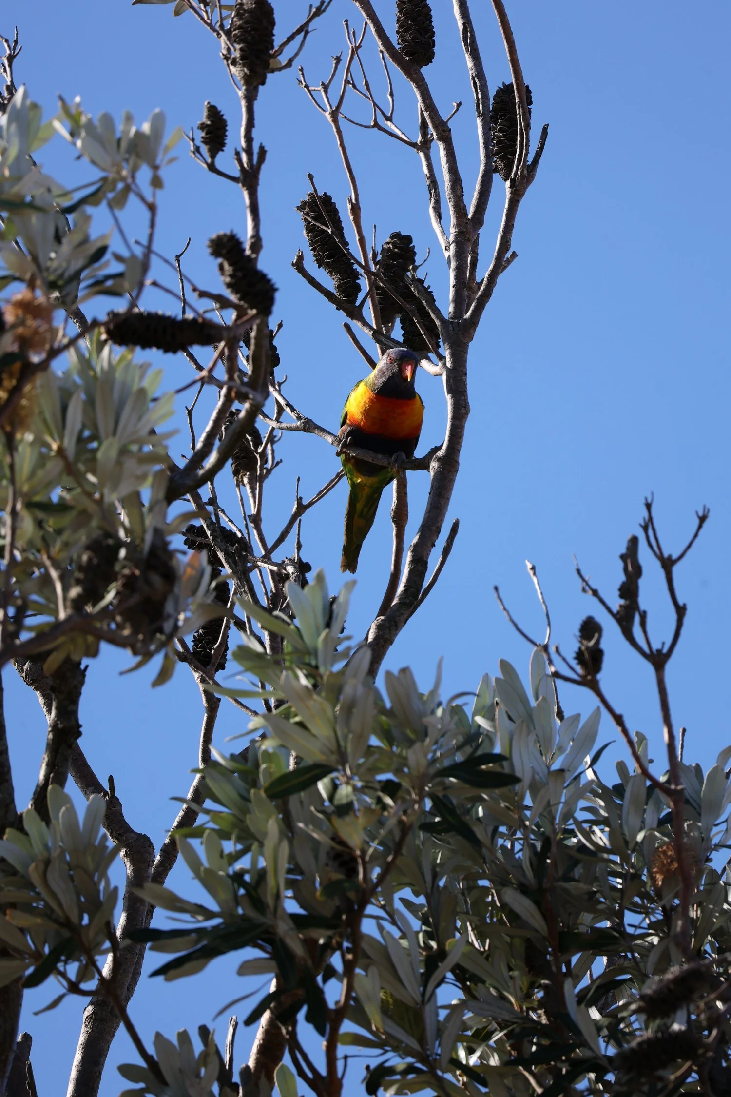
The native plants that line the path are particularly pretty when in flower and they ensure an abundance of native birds and other wildlife, long-nosed bandicoots and marsupial mice among them.
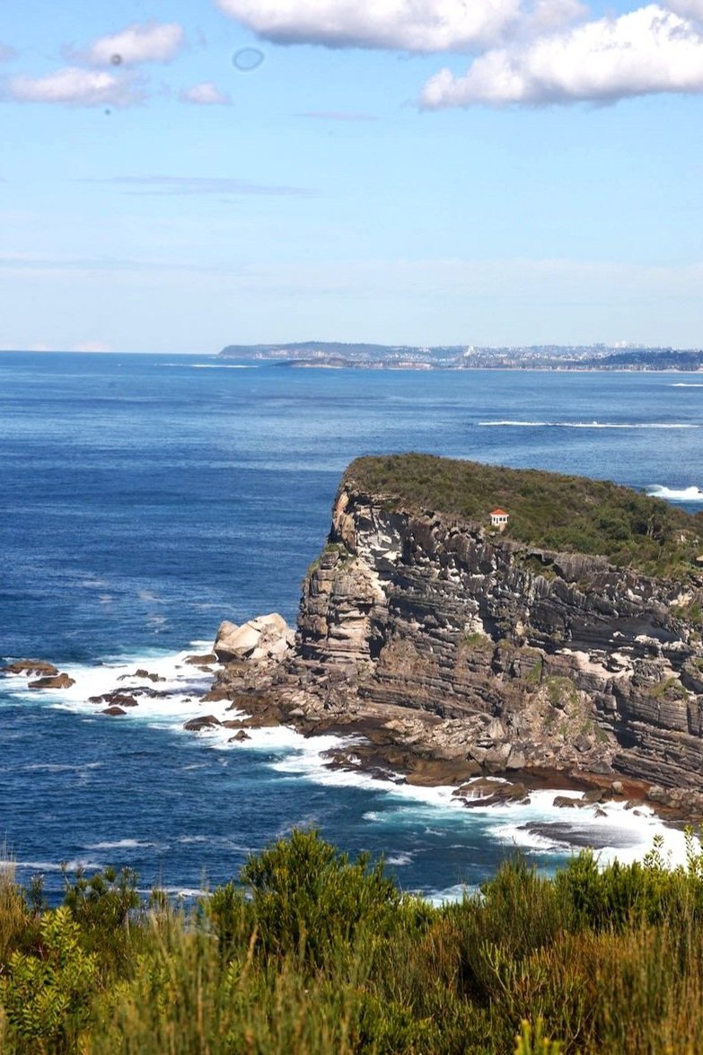
But the trees do obscure the views in sections so look out for a side path (marked on the map) where you can take in the magnificent vista below. Be careful though. There’s a very small shelf here with a very big drop
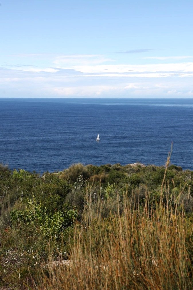
To Whale Beach
The headland trail leads to Careel Headland Reserve and then on to Whale Beach Rd.
You’ll be walking along this road for a bit, so take the time to sticky beak at some of the grand homes in the area. There’s a particularly huge one - can’t keep up with which celebrity owns it - being built in Raynor Rd, which you’ll pass as you head down to Malo Rd.


When you get to Malo Rd, turn right and take the steps at the end of the road onto Whale Beach.
Whale Beach is about 600 metres long and hidden away as it is, usually much quieter than its neighbours. There's a (shallow) 25 metre long rock pool at the southern end with toilets and showers, and a playground, surf club and cafe up behind the sand.
To the right of the surf club is Surf Rd. You can walk up here to rejoin Whale Beach Rd or walk to the end of the beach and take a set of steps up there. Which steps to take? You’ll see that there are many but most lead to private homes. The public stairway is set back in the reserve where the beach ends in a bend. (Ignore the ‘No entry sign’ which I gather is for the utilities box.)


To Palm Beach
This stretch of Whale Beach Rd is more exposed and winds around some blind corners so take care. There are no footpaths in some sections.
Continue along Whale Beach Rd, enjoying the expansive views over expensive rooftops, until you come to Florida Rd. Don’t turn left. Instead, take the pedestrian pathway over to the right. Yo’ll come to a set of timber stairs that lead to Palm Beach rock pool.
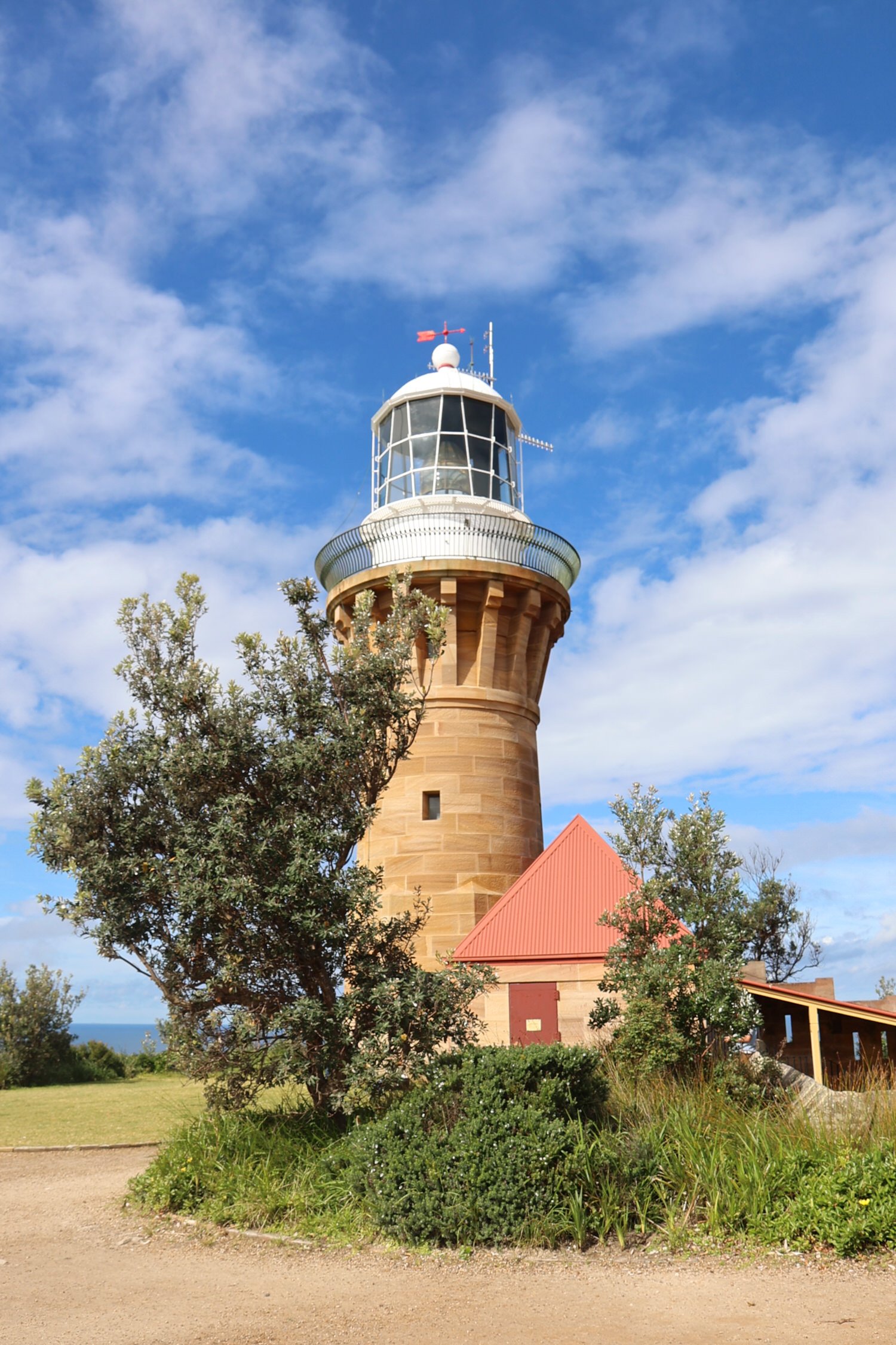
Standing on the stairs, take a moment to enjoy the view. Palm Beach stretches out in a sweep of two kilometres before you. Beyond it is Barrenjoey Headland with the lighthouse standing proudly at its peak. It’s little wonder this is a highly prized part of Sydney.
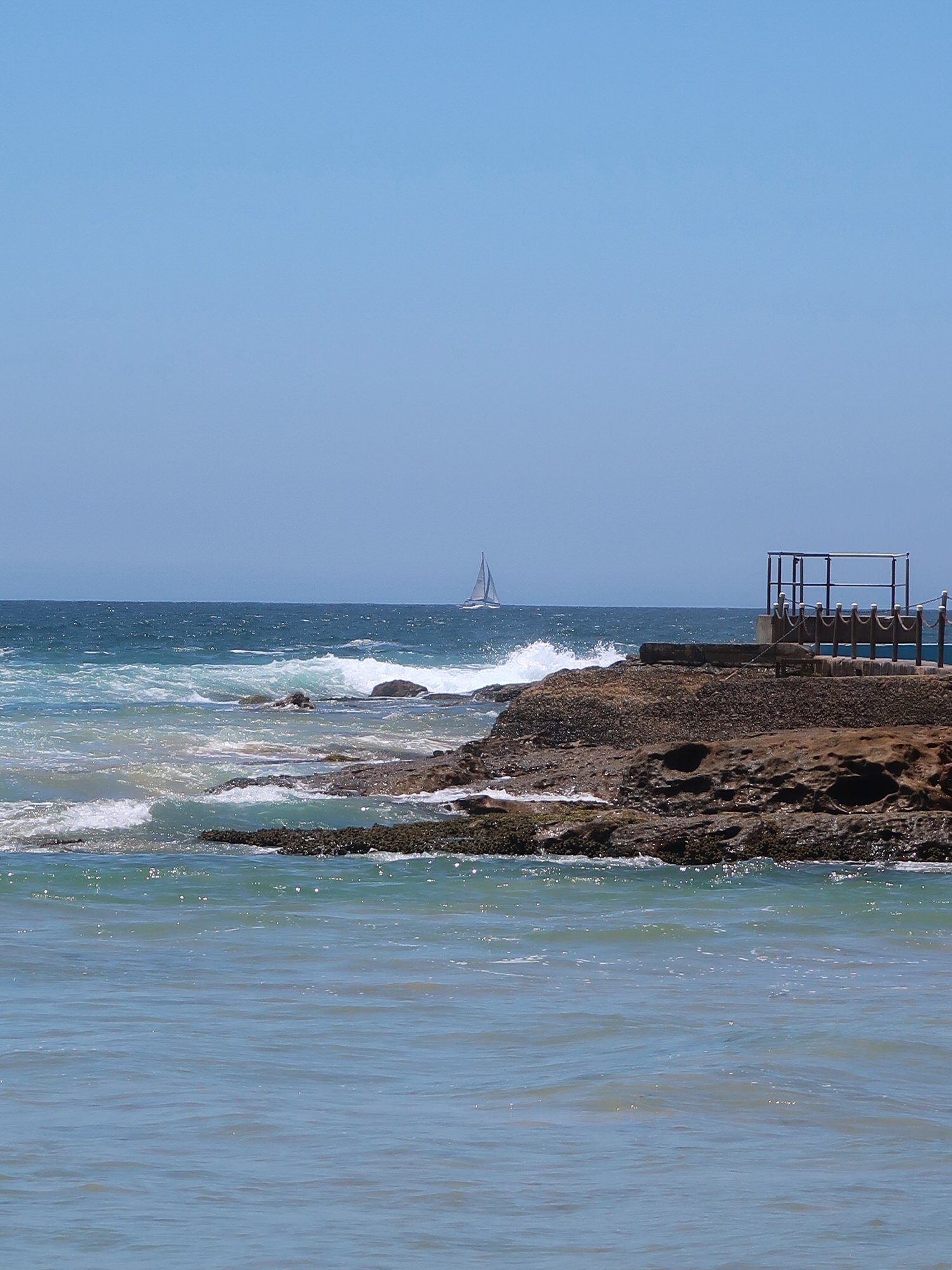

Palm Beach ocean pool is 50 metres long and gets a lot of use. Like all pools on the Northern Beaches, it closes for cleaning on a regular basis. You can check the cleaning roster here.
Continuing on from the pool and ‘Kiddies Corner’, you can walk along the sand most of the way to Governor Philip Park. Alternatively, take to the footpath where you’ll pass a few shops and cafes and some very beautiful homes.
Governor Philip Park, where this walking trail ends, sits above the north end of Palm Beach. You can stop for a meal or refreshments at the cafe or surf-club, or have a picnic in the pretty parkland. There are plenty of tables, bbqs and grassed areas, not to mention the beaches on either side.
if you’re not walked out, and still have a bit of puff, you could continue on up to Barrenjoey Headland.
If you’re heading back to the start by bus, the nearest stop is outside the Palm Beach Golf Club which adjoins the park.


In the area
The northern end of Palm Beach is Home and Away territory and if you’re a fan and here on a weekday, you might see some of the show being filmed.
The walk up to Barrenjoey Headland is highly recommended as an add-on to this one or one for another day.
Palm Beach has much to recommend it beside the surf beach. Station and Snapperman Beaches on the Pittwater side are pretty and protected or you could get a ferry over to the Basin from Palm Beach Wharf (about 10-15 minutes walk away). There are some great cafes and restaurants dotted along Barrenjoey Rd and gift shops and an art gallery also on this stretch.