Cronulla Loop Track
-
An easy coastal loop around the Cronulla peninsula, linking surf beaches, ocean pools, headlands and peaceful bayside parks.
Distance 8km Time 2 hours
Steps 12000
Level of Difficulty Easy -
North and South Cronulla ocean pools
Shelly Beach and Oak Park pools
Bass & Flinders Point lookout and monument
New boardwalk at Hungry Point
Darook Park and beach
Gunnamatta Bay and baths
Cronulla Wharf and ferry to Bundeena
-
As this is a loop walk you can start anywhere
Parking: Free parking along the beach front near Eloura Beach and surrounding streets (some spots are timed)
Public Transport: The walk starts near Cronulla Station - The train takes about an hour from the city.
Check tides if planning to walk the shoreline section near Darook Park
Ocean pools can be rough or submerged at high tide
Busy on summer weekends and holidays
Plenty of coffee and dining options near the beach and in Cronulla village
If you’re looking for an easy, mostly level walk, with stunning views and the chance for a dip along the way, this walk along the coastline at Cronulla ticks all the boxes. Following the shoreline, it links surf beaches, ocean pools, rocky headlands and sheltered bays, and the outlook shifts dramatically with the weather and tide and time of day.
Cronulla takes its name from the Gweagal word Kurranulla, meaning ‘‘place of the small pink seashell’’. The area is popular with tourists and well known for its surf culture.
WALKING THE TRAIL
Elouera Beach to South Cronulla
As this is a loop track you could start anywhere. We parked the car on Mitchell St opposite Elouera Beach, and set off from there.
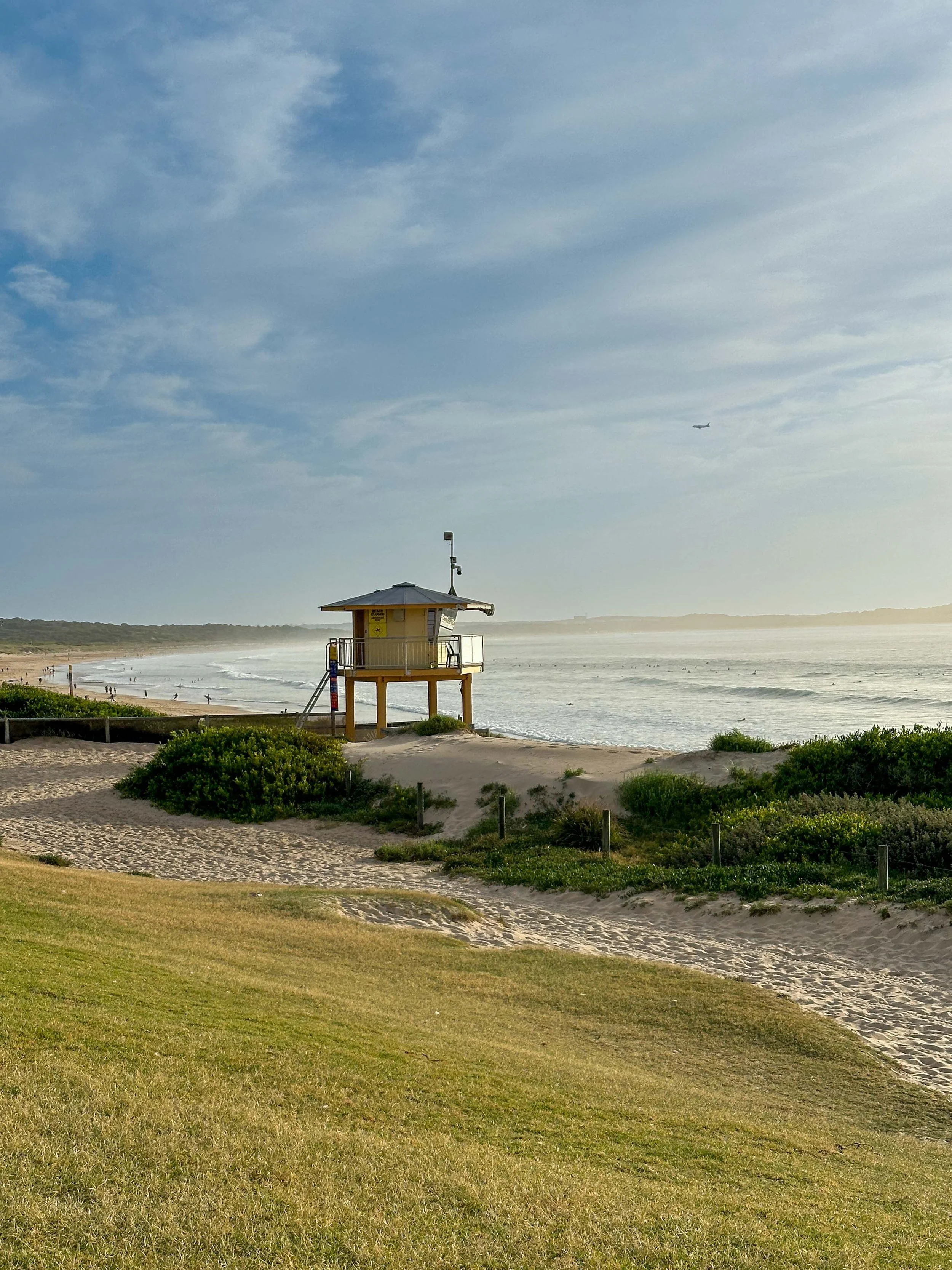
Heading south, follow the beach or roadside path toward North Cronulla. You’ll soon reach the surf club, with Dunningham Park and its large playground behind.
Continuing past cafés and restaurants, you come to the first of several ocean pools. Conditions vary greatly here: the smaller pool can be submerged at high tide and both can be rough, though there always seem to be swimmers willing to brave the surge.
The larger pool marks the start of Cronulla Beach (South Cronulla), the most frequented beach along this stretch and the only one patrolled in winter. Behind it sits Cronulla Park, popular for picnics and community events, with Cronulla Station just beyond. At the end of the foreshore path, take the stairs up to the Esplanade.
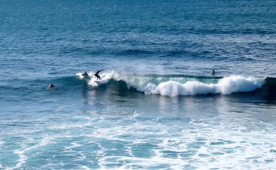
One of many ocean pools along the way
The Esplanade to Bass & Flinders Point
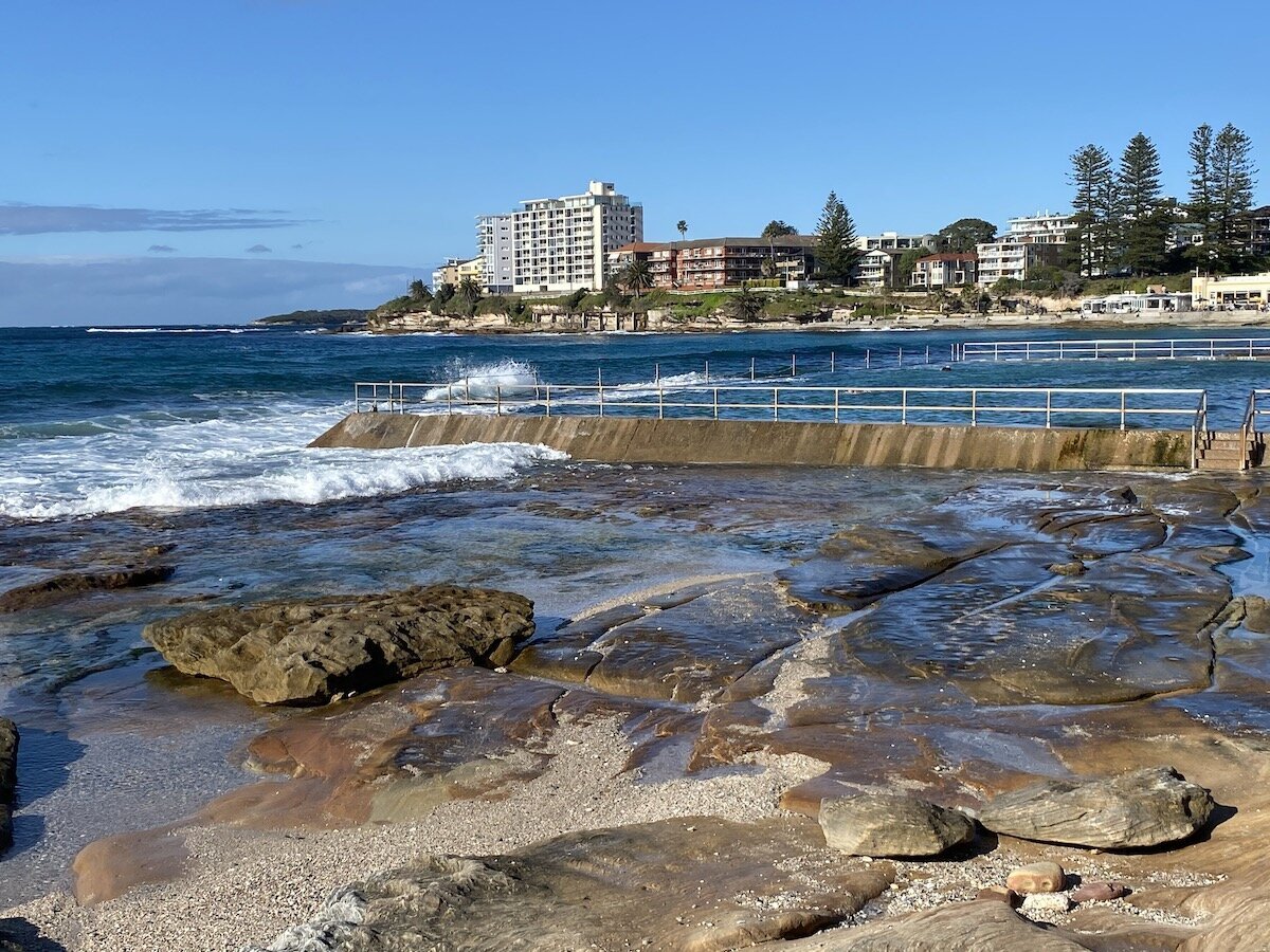
The Esplanade winds along the headland past Shark Island, Blackwoods Beach and Shelly Beach, where a large ocean pool sits beside a grassy park popular with families and fitness groups. The path curves around Glaisher Point toward Oak Park Beach.
This is a particularly pretty stretch of coastline. The water is a gorgeous blue-green colour and the richly toned rocks, pitted and rippled by the waves, make a striking contrast. You can scramble down roughly hewn paths at various points to the natural rock pools below, though it’s best to wait for the tide to go out.


At Oak Park Beach you’ll find another low lying rock pool nestled in between rock platforms which stem the force of the waves. Continue on from here toward Bass and Flinders Point.


Bass & Flinders Point
If you went to school in Australia, the names Bass and Flinders will be familiar. The monument here marks their arrival in 1796 aboard the Tom Thumb. Flinders later named Port Hacking after Henry Hacking, an explorer of somewhat dubious repute. (It is believed that it was Hacking who killed Aboriginal resistance fighter Pemulwuy in 1802.)
From the point, the path winds around to Salmon Haul Reserve, a scenic and relatively secluded spot for swimming, snorkelling and fishing. And there’s a playground here with amenities.


Hungry Point Clifftop Walk
A little way on from the reserve at the end of Cowra Place, is the start of the recently completed Hungry Point Cliff Top Walk. This much-heralded, elevated walkway traces the rocky shoreline giving expansive views over Port Hacking. It’s an impressive piece of infrastructure and has quickly become a destination in its own right.
At present, however, the walkway finishes at what council describes as a resting point but is, in effect, a dead end. To continue the Cronulla loop, retrace your steps and take the stairs up to Hungry Point Reserve.
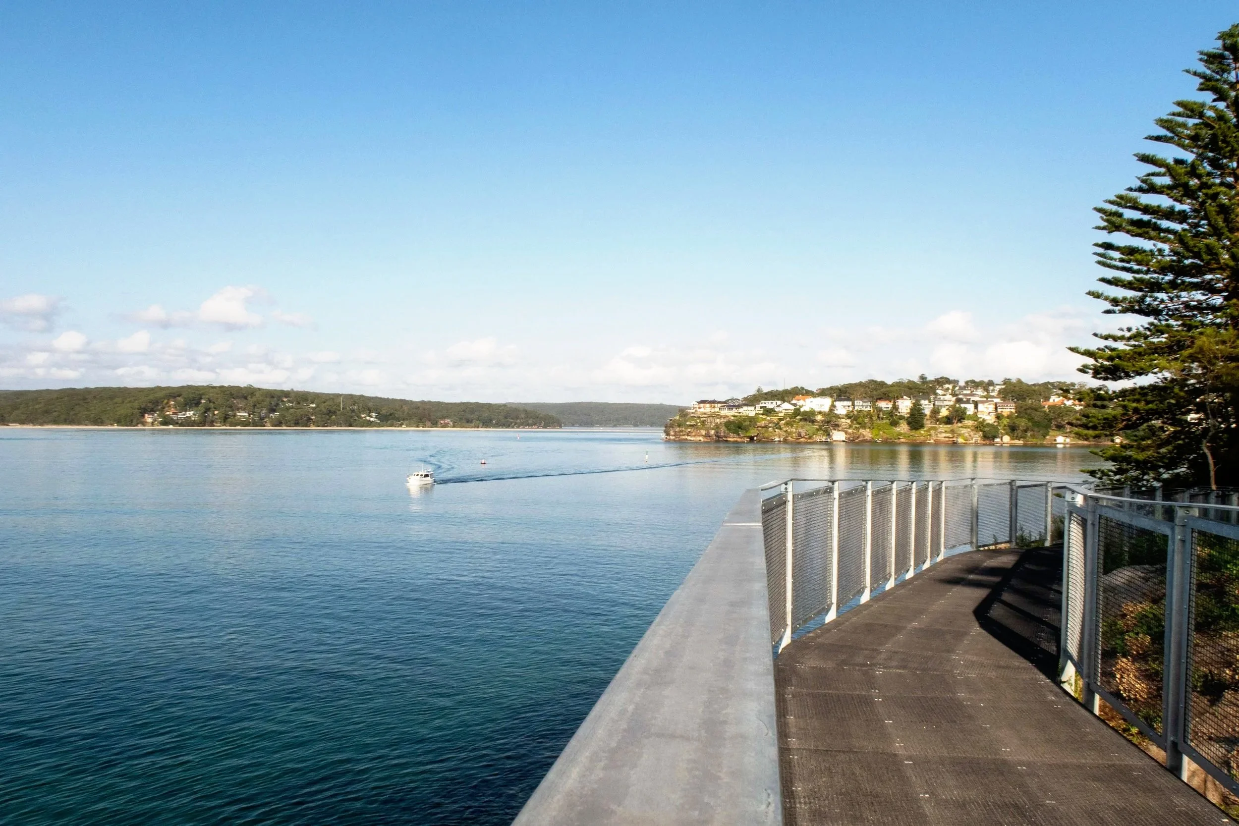
View from the Hungry Point Clifftop Walkway
Darook Park to Gunnamatta Park
Head west through Hungry Point Reserve to Darook Park, another attractive green space with beautiful big figs trees at the top and a tidal beach below.
Darook Beach is very peaceful especially on weekdays and its calm waters and gentle waves make it perfect for little ones, and its west-facing aspect makes it a lovely sunset spot.
At the end of Darook Park you have two options but your choice will be very much governed by the tides. At low tide, you can usually get around the point to Gunnamatta Bay Beach without too much trouble. When the tide is up though you’ll need to take the path up to Darook Park Road, then follow it to Nicholson Parade. Turn left and continue to Gunnamatta BayPark.
Gunnamatta Park is a large bayside reserve (around 14 acres) with BBQ facilities, a large playground, shelter sheds and an open-air amphitheatre. It sits on Gunnamatta Bay beside a small beach and netted tidal baths.
Walk on past Cronulla Sailing Club and some pretty impressive waterfront homes to Cronulla Wharf. Ferries depart from the wharf to Bundeena on the hour. Deep sea fishing and whale watching tours also leave from here.


To finish
From the wharf, the path climbs through Tonkin Park to the road and the pedestrian tunnel beneath the railway. The tunnel doubles as a small gallery, its walls covered in colourful murals and sea-themed artwork.
Emerging from the tunnel you’ll be thrust back into the noise and traffic of Central Cronulla. If you want to stop for lunch or a drink, there are plenty of options here.
Cronulla Station is within sight now but if you’ve parked at the beachfront, cross at the lights outside the station and follow the path down through Monro and Cronulla Parks to rejoin the beachfront at South Cronulla. From here it’s a short walk back up the hill to Elouera Beach.