Pyrmont Foreshore Walk
A Waterside Walk Along Pyrmont’s Historic Foreshore
-
A relaxed harbour foreshore walk linking parks, wharves and historic industrial sites around Blackwattle and Pyrmont Bays.
Distance: 6.5 km Time: 2 hours
Steps: 11,000
Level of difficulty: Easy -
Views to Anzac Bridge & Glebe Island Bridge
Pirrama Park playground, public art & former baths site
Jones Bay Finger Wharf heritage structures
Darling Island parks & harbour outlooks
Australian National Maritime Museum & historic vessels
Pyrmont Bridge views to Barangaroo & Darling Harbour
-
Paid parking along Bank Street; light rail stops nearby
Mostly flat, paved foreshore paths — suitable for prams and bikes
Limited shade
Toilets, cafés and picnic areas at several parks along the route
You could shorten the walk by returning on light rail from Pyrmont Bay
This is an easy waterside stroll through parts of Sydney Harbour once crowded with wharves and heavy industry and largely inaccessible to the public. The pathway around the harbour is now peppered with parks, playgrounds and picnic areas, with plenty of places to stop for a bite and take in the harbour views.
WALKING THE TRAIL
Old Sydney Fish Market to Waterfront Park
The walk begins and ends at the former Sydney Fish Markets site. There is paid parking along Bank Street and in the surrounding area. Alternatively, the light rail from Central stops just up the road.
Walk to end of Bank St where it becomes Bowman Street and take the pedestrian pathway on your right that leads down to the waterfront.
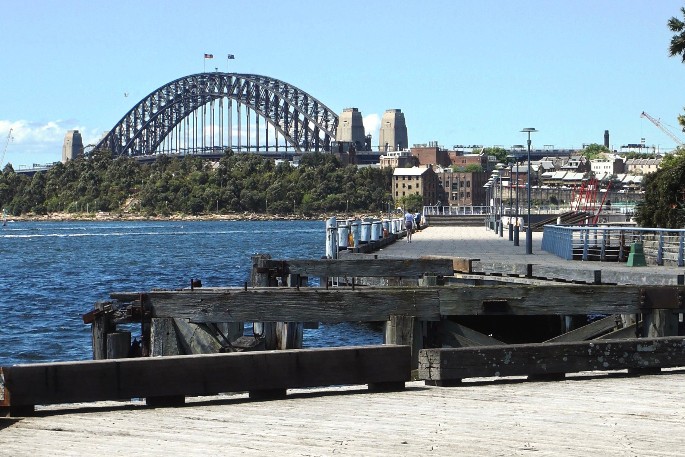
The Anzac Bridge looms large on your left as you turn to take the path along the water. In front of it sits the swing and control house, of the Glebe Island Bridge which it replaced in 1995.
Waterfront Park
Waterfront Park has a small playground, picnic and barbecue area. This apartment complex above the park was built in the 90’s and is known as Jacksons Landing.

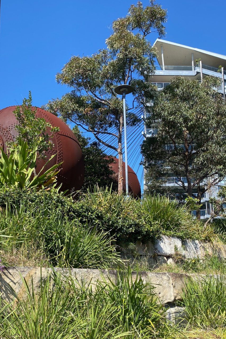
If you’re wondering what the big spheres are at the top of the park, they are Caneite defibrators, formerly used by CSR in the production of cane-ite building board. The Colonial Sugar Refining Company operated in Pyrmont for about 100 years and had a huge influence on the landscape of the Pyrmont area.
CSR began refining sugar in Pyrmont in 1870 and grew into the area’s largest employer, producing not only sugar but by-products such as molasses and alcohol, and later building materials like caneite. During the war years the works also turned to the production of armaments. In 1995, after operations had moved elsewhere, CSR’s industrial site was sold to Lend Lease who developed the area into what we see today.

This aerial photograph of the CSR refinery demonstrates the extent to which the company’s operations dominated the area (State Library Collection)
Pirrama Park
The access and amenity around this foreshore park provide a great example of what can happen when people get together to campaign for the greater good.
This area, once home to wharves and heavy industry, was most recently the headquarters of the Sydney Water Police. When the police secured a new site for their activities in the early 2000’s, a high-rise development not unlike the one next door was planned for this site. But locals were strongly opposed and in 2003 a spirited community campaign opposing the plans got underway. The campaign was ultimately successful and in 2005, the City of Sydney acquired the land and preserved it as public recreational space.


Pirrama Park was officially opened in 2010. It has BBQs and picnic tables, cafes and public art. There is also a large playground catering to the growing number of young families in the area.
The Stevedore Walk, which runs alongside the water, commemorates the maritime workers and industries that were based on and around the site. A kink in the boardwalk marks the spot where the popular Pyrmont Public Baths operated from 1877 until 1945.
The sculpture, Tied to Tide was installed here in 1999. Its kinetic movements reflect the changing tides and prevailing winds. The timber used in its creation was taken from the old Goldsbrough Mort wool stores in Pyrmont.
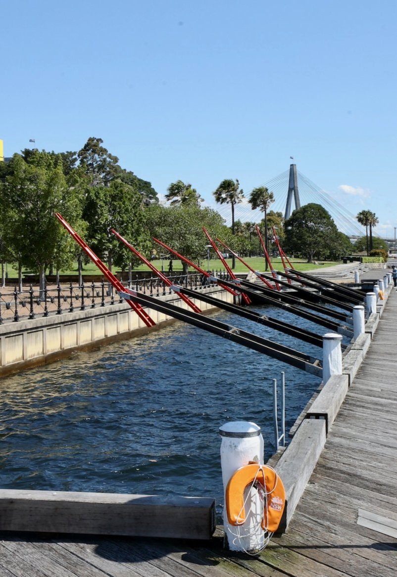
Tied to Tide by Jenny Turpin and Michaelie Crawford
Pirrama Park to Jones Bay Wharf
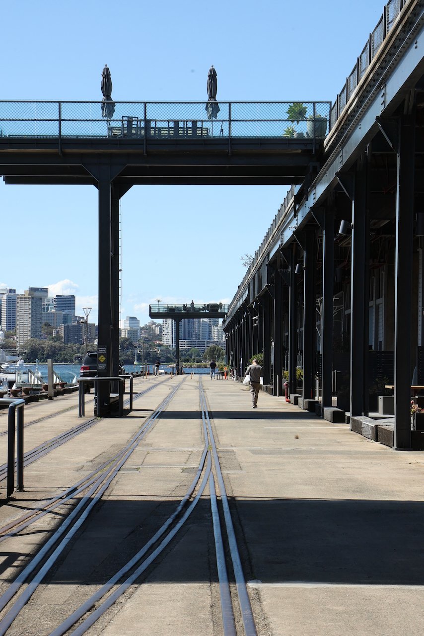
The wharves at Jones Bay were constructed in the early twentieth century to help manage growth in the export of wool, wheat and other produce from New South Wales. Rail lines ran directly onto the wharves, allowing cargo to be moved efficiently by crane and gantry.
As well as cargo, Jones Bay Wharf has also facilitated the swift movement of large numbers of people. In the war years, tens of thousands of troops came in by rail and set off from here, and in the years following many migrants disembarked here.
Today the wharf is home to the large function centre Daltone House, as well as a number of dining and commercial office spaces. You’ll see though as you walk around the wharf, that remnants of its working past are still in evidence.

Jones Bay Wharf to Darling Island
Despite the name, Darling Island has long since lost its island status through land reclamation. Like the finger wharf beside it, it has served as a handling station for wheat, coal, wool and other cargo, and as a passenger terminal for migrants in the post-war years.
Darling Island is now a mix of residential, commercial and public use buildings. A few early buildings remain including the prominent red-brick, heritage-listed former Ordnance Stores of the Royal Edward Victualling Yard. Built between 1902 and 1912, The REVY, as it is now known, has been converted into a luxury apartment block.
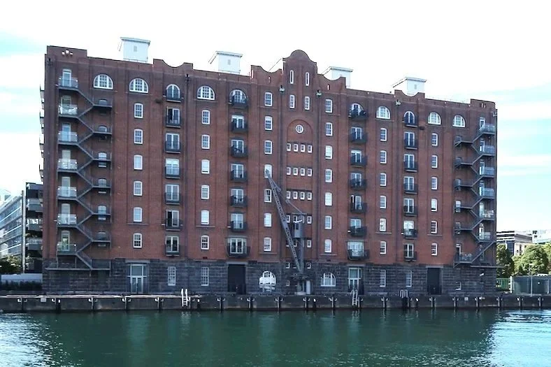
The REVY, Darling Island
Also on this peninsula are two small parks, Ballaarat and Metcalfe, both with grassed recreation areas and scenic views of Darling Harbour and the city skyline. There is also a small wharf catering to clients of the nearby Star Casino.
Darling Island to Pyrmont Bridge
Turn left to Pyrmont Bay Park just beyond the wharf on Pirrama Road, opposite the casino. The pathway through the park will lead you down toward Pyrmont Bay and the Australian National Maritime Museum.
Designed by renowned local architect Philip Cox, the museum was built in 1991. Its footprint includes the waterfront leading around from the ferry wharf where a number of the museum’s vessels are moored. The foreshore path passes the 100-metre long Welcome Wall, inscribed with the names of thousands of migrants to Australia.


If you have time to visit the museum, it’s worth the entry fee, even if you’re not a big naval fan. Entry gives you access to a number of permanent and temporary exhibitions and the opportunity to board some of the historic vessels, including a replica Endeavour and naval destroyer, HMAS Vampire.
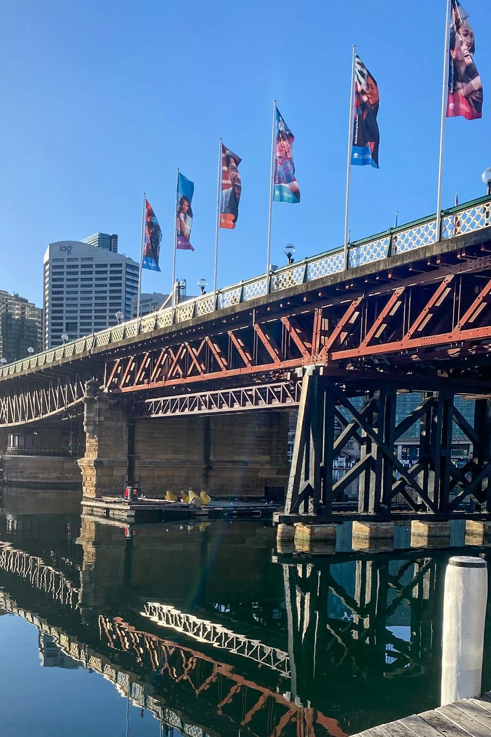
Just beyond the museum is Pyrmont Bridge, the turnaround point for this walk. Built in 1902 to replace an earlier bridge, it closed to traffic in 1982 and now serves as a pedestrian link to the city. From the bridge you can look one way toward Barangaroo and the other across Darling Harbour.
The return
To return to the start, head up to Pyrmont Bay Road and follow it all the way to Bank Street and the fish markets. Alternatively, if you have the time and would prefer to look at water rather than traffic, head back the way you came.
If you’re short on time or energy, the light rail will take you back as far as the fish markets in under ten minutes.

LAST UPDATED JANUARY 2026