Taren Point to Woolooware Bay

TAREN POINT TO WOOLOOWARE BAY
Distance 6 km Steps 10000
Time 1-2 hours Level of Difficulty Easy
This out and back trail in Taren Point winds around Woolooware Bay and looks out to Botany Bay.
Popular with locals, the route has been improved in recent years and the pathway widened to allow plenty of room for walkers, cyclists, wheelchairs and prams.

To start
The easiest way to get to the start of this walk is to drive. There is a small car park at the end of Alexander Avenue and additional parking in the surrounding streets.
Facing the water, the path begins on your right. But you may wish to have a short wander around the Shorebird Reserve (bubbler and toilets here), before taking the pathway around the bay.


The Trail
The trail is easy to follow. It is characterised largely by mangroves on one side and an evolving industrial/residential landscape on the other. The well-designed boardwalk is extensive and floats over the bay in sections and there are sealed footpaths in other areas.
At one point on the walk (near Atkinson Road), signs will direct you away from the waterside and you’ll meander through a few streets before rejoining the bay.
The turnaround point is just beyond the Solander Playing Fields. A small cafe, TOAST 2230 is nearby and open 7 days.
Keep an eye and ear out for cyclists - the pathway is shared for much of the way

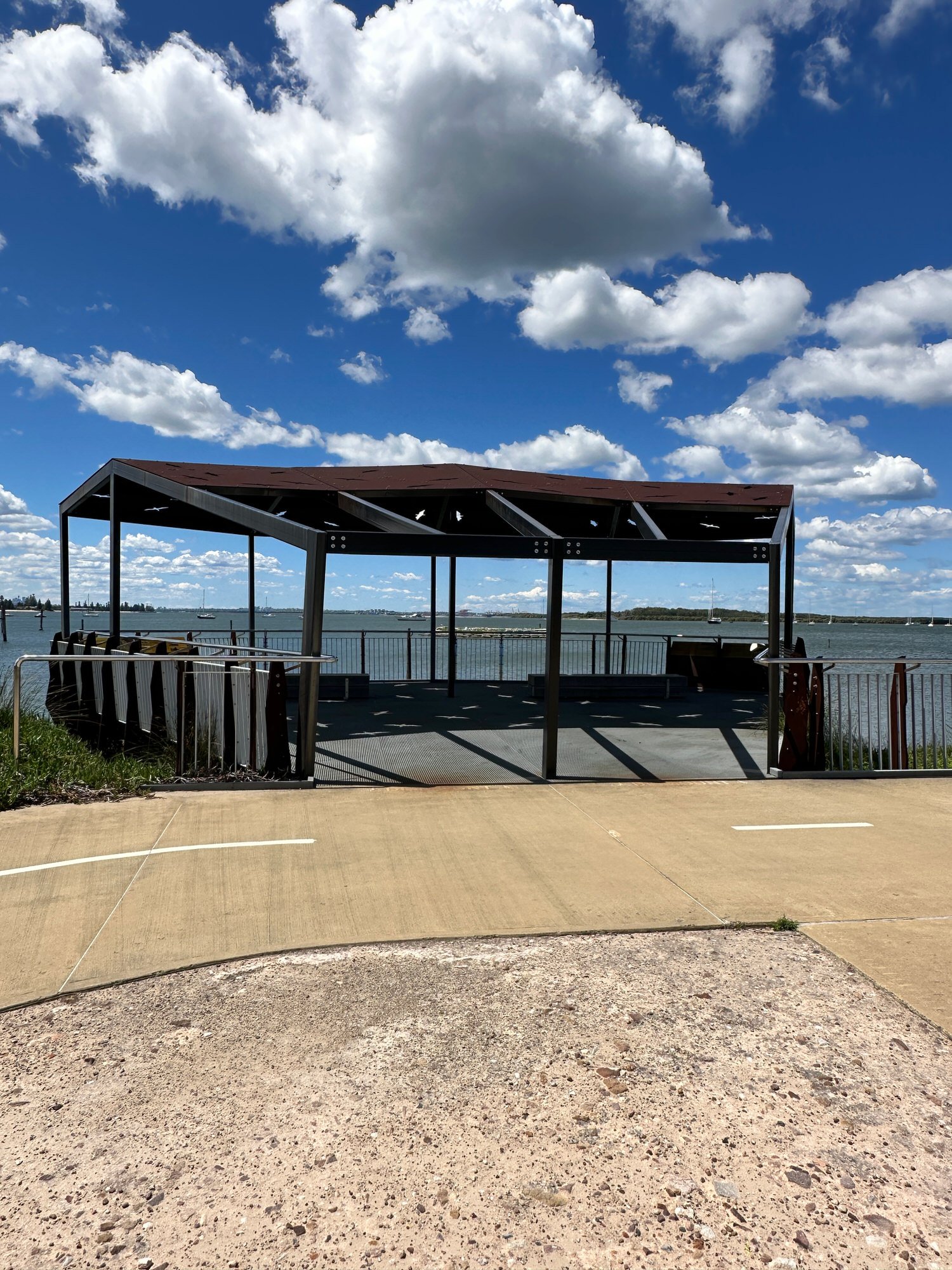
Looking out over Botany Bay and Port Botany


A little history
The name Woolooware is derived from the Aboriginal word Wooloowa, meaning muddy track. This echoes the area's natural low lying mud flats, dense stands of mangroves, salt marsh and once dominant tea tree and black wattle scrub.*
This area is a part of the traditional lands of the Gweagal people, a clan of the indigenous Dharawal nation. Over many thousands of years the sea and land here provided the Gweagal with an abundance of fish and shell fish as well as bush foods like figs and yams
European settlers in the area were quick to take advantage of the quality and quantity of oysters here in particular.
The oyster industry flourished here from the late 1800s to the 1990s. Not far from the start of the walk you’ll see remnants of the industry including an old oyster jetty, post WWII Nissen Huts and old stone oyster beds, all visible from the pathway. You can learn more from the interpretive signage nearby.


Wildlife in Woolooware Bay
Once heavily contaminated, this waterway is now home to a large shorebird community which includes Sandpipers, Bar-Tailed Godwits and Pied Oyster Catchers.
Each year, over 30 different kinds of migratory shorebirds visit Woolooware Bay and Towra Point Nature Reserve. Many of these birds are listed as endangered or vulnerable which is why dogs are not allowed along this foreshore.
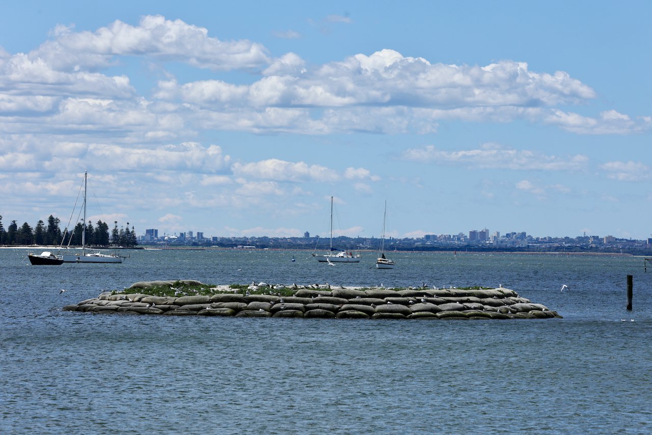
When the old oyster jetty was restored, a sand island was constructed to provide a roosting and nesting habitat for the birds. The screens you’ll see near the viewig platform were erected to shield the shorebirds from disturbance from pedestrians and cyclists.


Other birds you might meet along the path include Fairy-Wrens, Welcome Swallows, Figbirds and a variety of honeyeaters. And among the mangroves you may see Herons, Cormorants and other common waterbirds.
In the area
There are miles of sandy beaches not far from here but you’ll have to get back in the car to access them. Towra Beach and the adjoining Towra Point Nature Reserve is ideal for swimming, boating and kayaking and the mudflats and fresh water wetlands offer opportunities to see local and migratory birds.
If you’re looking for another walk nearby, head down to South Cronulla and take the beautiful Cronulla Loop Track. About the same distance by car (10-20 minutes) are the Cape Bailey Track (great for whale watching) or the Kurnell Foreshore Walk (history, beaches and more).
*www.sutherlandshire.nsw.gov.au/__data/assets/pdf_file/0019/4555/Cycling-guide-WOOLOOWARE-BAY-to-KURNELL.pdf