Cape Baily Track
A dramatic clifftop walk in Kamay Botany Bay National Park
-
A dramatic clifftop walk from Cape Solander to Cape Baily Lighthouse in Kamay Botany Bay National Park.
Distance: 4 km Time: 2 hours
Steps: c6,000
Level of difficulty: Easy–Moderate (exposed and uneven rock) -
Cape Solander whale-watching platform (Season is May–Nov)
Chance sightings of whales, dolphins and seabirds
Sweeping ocean cliffs and rock platforms
Coastal heath wildflowers (spring)
Cape Baily Lighthouse
Views south toward Boat Harbour and Cronulla
-
Very exposed — sun protection essential; wind can be strong
Stay well back from cliff edges (soft, brittle sandstone)
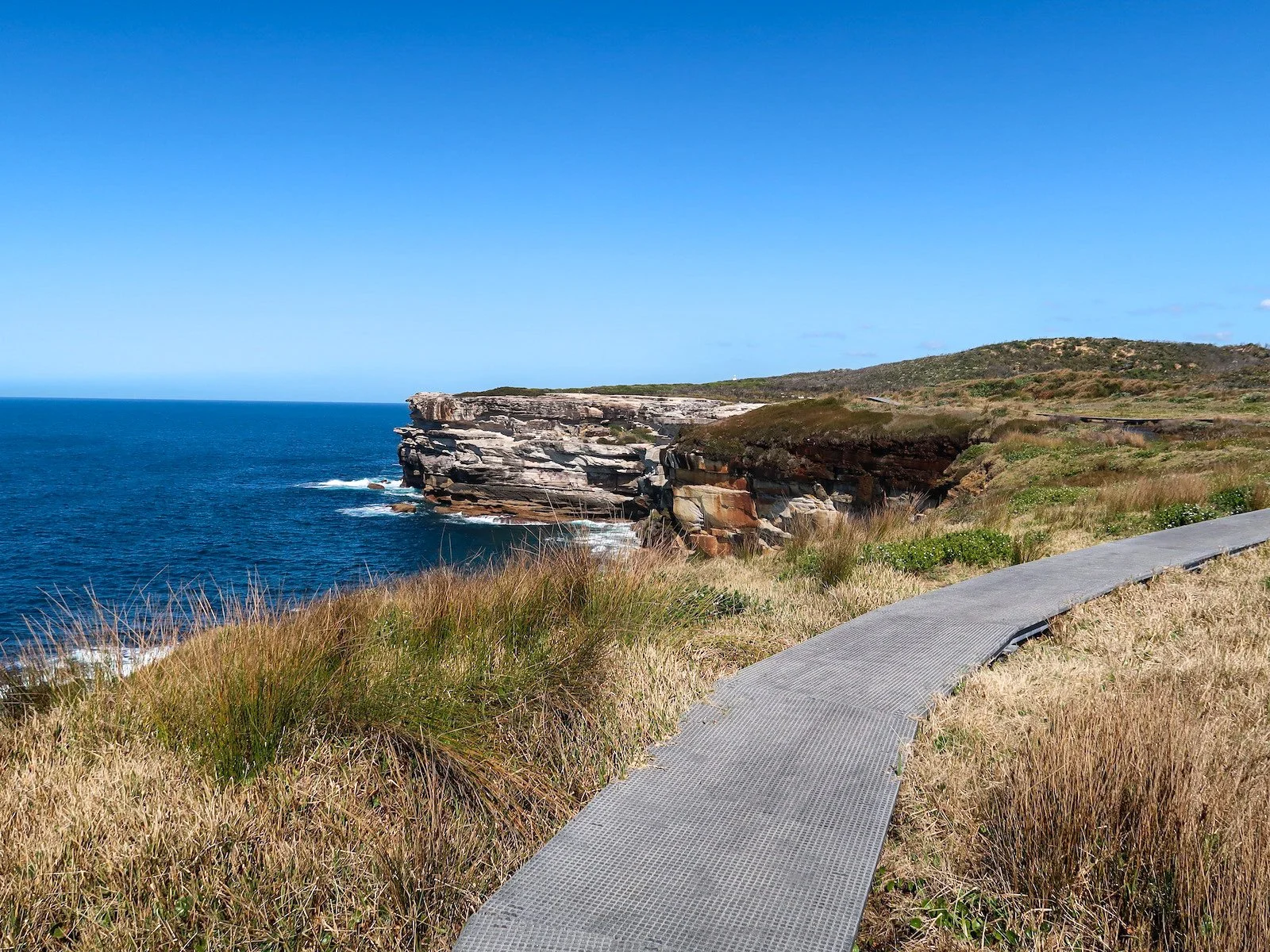
Track surface varies: sand, rock platforms and boardwalk
Busy on weekends and during whale season
Parking at Cape Solander car park ($8/day; card/coins)
No shade or facilities along the track
Best wildflowers: late winter–spring
This spectacular out-and-back clifftop walk lies within Kamay Botany Bay National Park, just around the headland from Captain Cook’s landing place. It begins at Cape Solander — named for Daniel Solander, fellow-botanist to Joseph Banks — and follows the exposed coastline south to Cape Baily Lighthouse.
We did this walk on a beautiful sunny weekday at the start of spring, when the wildflowers were blooming and the track quiet. It can get very busy on weekends, especially in whale watching season.
WALKING THE TRAIL
Cape Solander to the coastal heath track
Cape Solander lookout is a short walk from the car park at the end of Cape Solander Drive. The large whale-watching platform here draws crowds between May and November as humpback whales migrate along the coast. With luck you could also spy Southern right whales, bottlenose dolphins, minke whales or New Zealand fur seals from this point.
From the lookout, wayfinding is simple: head south toward the lighthouse with the ocean on your left.

Humpback whale as seen from the cliffs on the Cape Bailey Track
Along the cliffs to Cape Baily
The trail is fairly level, sandy in parts with vast rock platforms and steel boardwalks that make it easier to navigate marshy areas.
The landscape is dramatic — barren yet beautiful — with sheer cliffs dropping several metres to the ocean below. It’s tempting to peer over the edge but the sandstone ledges looked a little too brittle to me so I kept my distance and stuck to more solid rock platforms. Some of these platforms are quite striking. Wind and weather have painted patterns in them leaving gorgeous ripples and swirls on their surface.


Cape Baily Lighthouse & return
Cape Baily Lighthouse stands a little way up the hill off the main path. Just who Baily was I have no idea (anyone?), but the lighthouse was opened in 1950 and it still operates today, powered by solar panels. The lighthouse itself is nothing to write home about but from its base you get some pretty good views to the city and over the surrounding coastline.


From here, the track continues south toward Potter Point, Boat Harbour and eventually Cronulla. We turned back at the lighthouse, retracing our steps toward Cape Solander.
Flora & fauna
We did this walk in the springtime, perfect for viewing the magnificent wildflowers that carpet the rocks in some areas. The colours are just beautiful and they stand out starkly against the muted greens of the native shrubs and grasses in an otherwise open and rocky landscape.


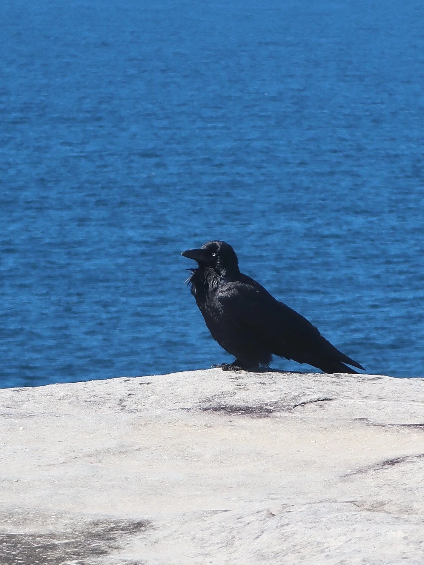
There is a lot of birdlife in the area, especially in the spring, and we saw honeyeaters and tiny wrens feasting on fresh flowers. But most prevalent in size and number are the jet black crows that nest in the shrubbery and feed on the many insects and small lizards that traverse the track.

In the area
Another walk you might enjoy in the area is the Kurnell Foreshore Walk, just down the road. This walk traces the calmer northern shore of the peninsula, while also dipping into Kamay Botany Bay National Park. Close by, the Cronulla Loop Track follows the coastline passing several surf beaches, ocean pools, rocky headlands and sheltered bays.
A little further afield, the Wattamolla to Eagle Rock walk in Royal National Park shares many of the same features as this one: dramatic cliff-top views, striking rock formations and a rich mix of native flora and fauna.
LAST UPDATED FEBRUARY 2026