Rose Bay to Watsons Bay
A harbour foreshore walk with beaches, bushland and historic headlands
-
A classic harbour walk linking beaches, bushland and historic headlands
Distance 8km Time 2-3 hours
Steps 12,000
Level of Difficulty Easy/Moderate -
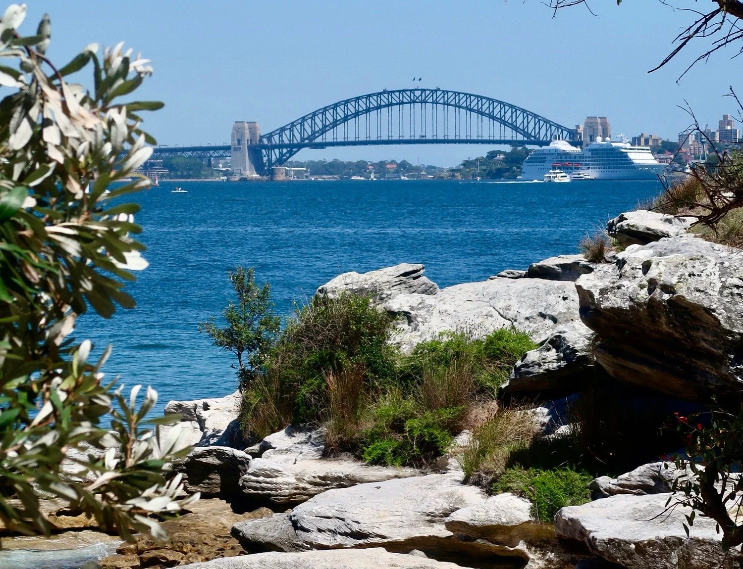
Spectacular harbour views
Hermitage Foreshore trail
Parks, playgrounds, picnic areas and places to swim at regular intervals
- Rose Bay Beach (kayak and paddleboard hire available)
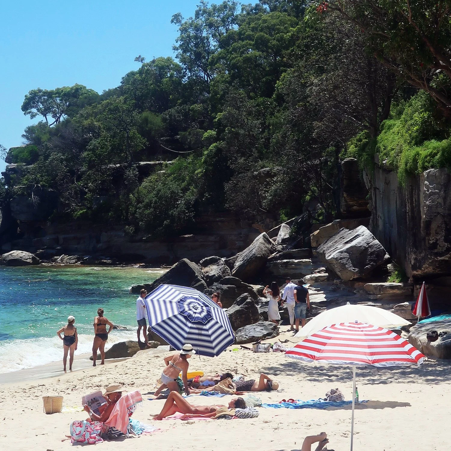
- Milk Beach - secluded and ideal for a swim
- Nielsen Park / Shark Beach (netted swimming area)
- Parsley Bay Reserve - family-friendly, sheltered beach
- Robertson Park at Watsons Bay - Finish up with a swim or picnicHistoric sites & lookouts (on the trail or nearby)
- Vaucluse House & Gardens (museum and tea rooms; Wed–Sun 10am–4pm).
- Greycliffe House (neo-Gothic Victorian house in Nielsen Park).
- Strickland House (heritage mansion on the Hermitage Walk).
- The Gap (dramatic clifftop lookout with harbour views)
- Hornby Lighthouse (built 1858, still operating).Dining & refreshments
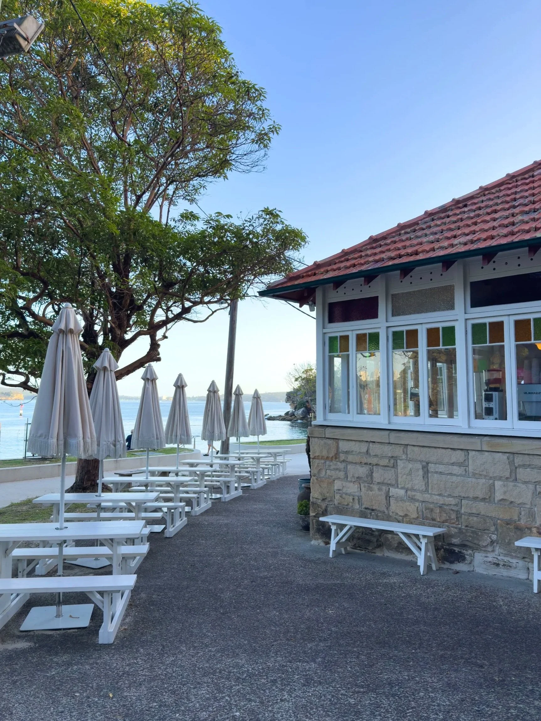
- Nielsen Park Kiosk (Open 7am-7pm daily serving breakfast, casual meals, fish and chips, coffee).
- Parsley Bay Café (coffee and light meals; daily ~9:30am–2/3pm).
- Watsons Bay Hotel (pub dining with harbour views).
- Doyles on the Beach / Doyles Takeaway (iconic seafood).
-
This is a one-way walk and can be done in either direction. The best way to start and end the walk is via ferry, but other options include:
Bus routes 324, 325 or 326 from the city to Rose Bay. Routes 324 or 325 return to the city from from Watsons Bay.
Limited street parking at both Rose Bay and Watsons Bay — ferry is strongly recommended.Toilets are available at Rose Bay Beach, Nielsen Park, Parsley Bay and Watsons Bay.
It can get very hot in summer — start early and pack sunscreen and a hat.
Nielsen Park and Watsons Bay are busy on weekends and holidays; mornings are quieter.
Watch your food around the kiosk and picnic areas at Nielsen Park — kookaburras may try to steal it.
Clocking in at around 8 kilometres and boasting drop dead gorgeous views, this walk will give a sizeable boost to your weekly step count. Starting at one wharf and finishing at another, the route follows foreshore paths, boardwalks and quiet streets, with frequent opportunities to swim or picnic along the way.
I set out on this walk on what I thought was a fairly mild summer’s morning, but the days heat up quickly in Sydney in February and I was soon working up a sweat. There are so many beautiful beaches along the way you’ll regret it (as did I), if you’ve not come prepared for a swim.
WALKING THE TRAIL
The walk begins with a ferry ride from Circular Quay which is always a treat. The trip from Circular Quay to Rose Bay takes about twenty minutes.
Rose Bay Ferry Wharf
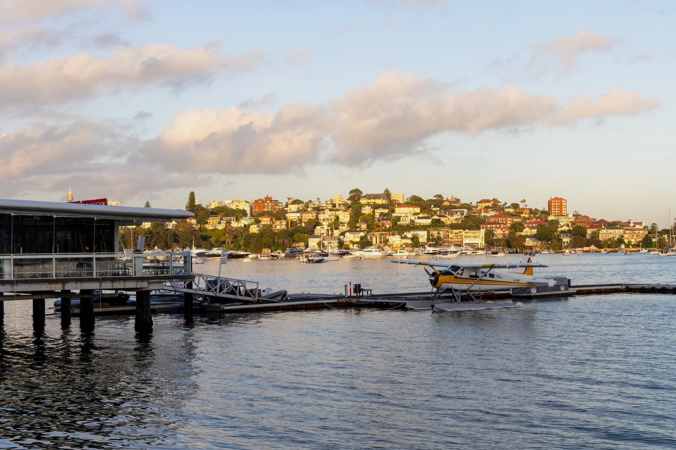
Rose Bay Wharf to Hermitage Foreshore
From the wharf, turn left and follow the Lyne Park pathway past Catalina Restaurant and the offices of Sydney Seaplanes. It’s hard to imagine now, but this was once home to Sydney’s first airport - the Rose Bay Boat Base, built in 1938, where seaplanes departed on the ten-day "Kangaroo Route" to London.
Continuing on along the path you’ll pass a large playground and a small sailing club before hitting Rose Bay Beach. With its white sand and clear water, this is a popular local swimming spot, though it can be surprisingly quiet on weekdays.
Leave the beach via the public steps at Dumaresque Reserve. At high tide you may need to detour earlier via Caledonian Road. Turn left on to New South Head Road and continue up to Tivoli Avenue. Here, take another left turn and left again into Bayview Hill Road, where you’ll pass the impressive grounds of Kincoppal and Kambala schools, before reaching the entrance to the Hermitage Foreshore Walk.
Hermitage Foreshore Walk to Nielsen Park
The Hermitage Foreshore Walk is a 1.8-kilometre highlight of the route, tracing the harbour edge past small beaches, shaded picnic areas and the historic Strickland House. The path is mostly flat and well maintained, with boardwalks and plenty of places to stop and take in the view.
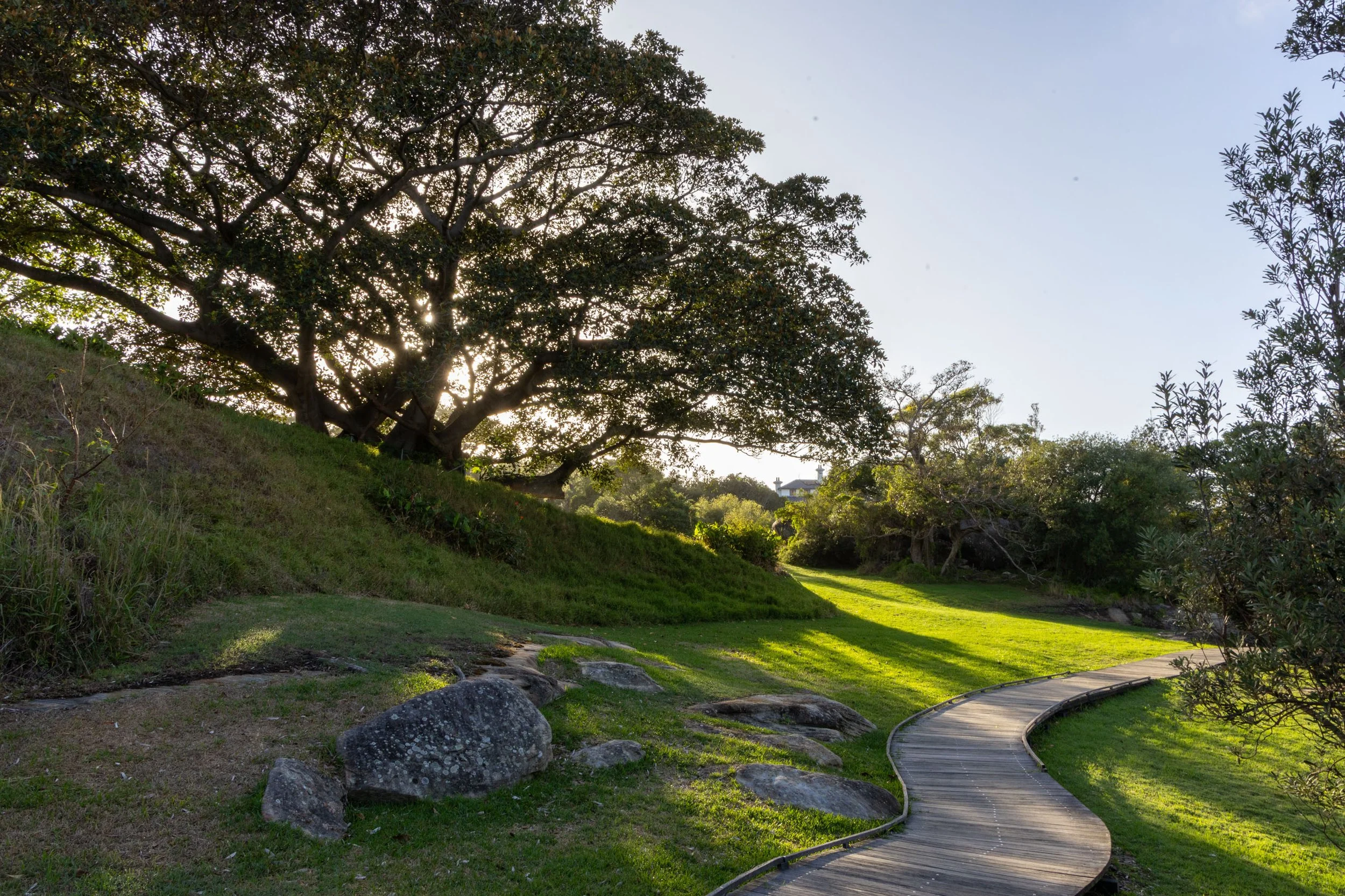
Hermitage Walk
Towering figs, paperbarks and native foliage line the track, attracting birds, bees and butterflies — and the occasional artist armed with a sketchbook. Of the many inviting beaches along this stretch, Milk Beach is a standout. Tucked below Strickland House, it’s an ideal spot for a swim or quiet break before continuing on.
As the track descends, the atmosphere and the landscape shift. And when the sound of birdsong gives way to squealing children, you’ll know that you have reached the end of the Hermitage walk and are entering Nielsen Park.
Nielsen Park to Parsley Bay Reserve
Nielsen Park is a popular spot. Managed by National Parks, it sits on the traditional land of the Gadigal and Birrabirragal clans of the Eora Nation. Evidence of long-term occupation has been found throughout the park.
Shark Beach is protected by a netted enclosure, ideal for families and swimmers. The grassy parkland is the perfect place to break out the picnic basket or you can pick something up from the park’s cafe or kiosk.
Before you leave Nielsen Park, it’s worth taking a short detour to Bottle and Glass Point for views over Vaucluse Bay. The sandstone columns here were named in 1799 for their resemblance to glassware, though time and erosion have softened their forms.
Leaving Nielsen Park, via Greycliffe Ave, head up Coolong Road before turning left on to Wentworth Rd. Along the way, you’ll pass signs to Vaucluse House, a heritage-listed estate open to the public and worth a visit if time allows.
Parsley Bay Reserve to Watsons Bay
Continue along Wentworth Rd which loops around into Fitzwilliam and then down to Parsley Rd where you’ll see the laneway entrance to Parsley Bay Reserve. For a more dramatic entry to the reserve, follow Wentworth Rd to its end where it turns right into Fitzwilliam. On Fitzwilliam Rd near number 43, look out for a small path which leads to Parsley Bay Bridge. Cross over this suspension bridge and take the steps down into the reserve.
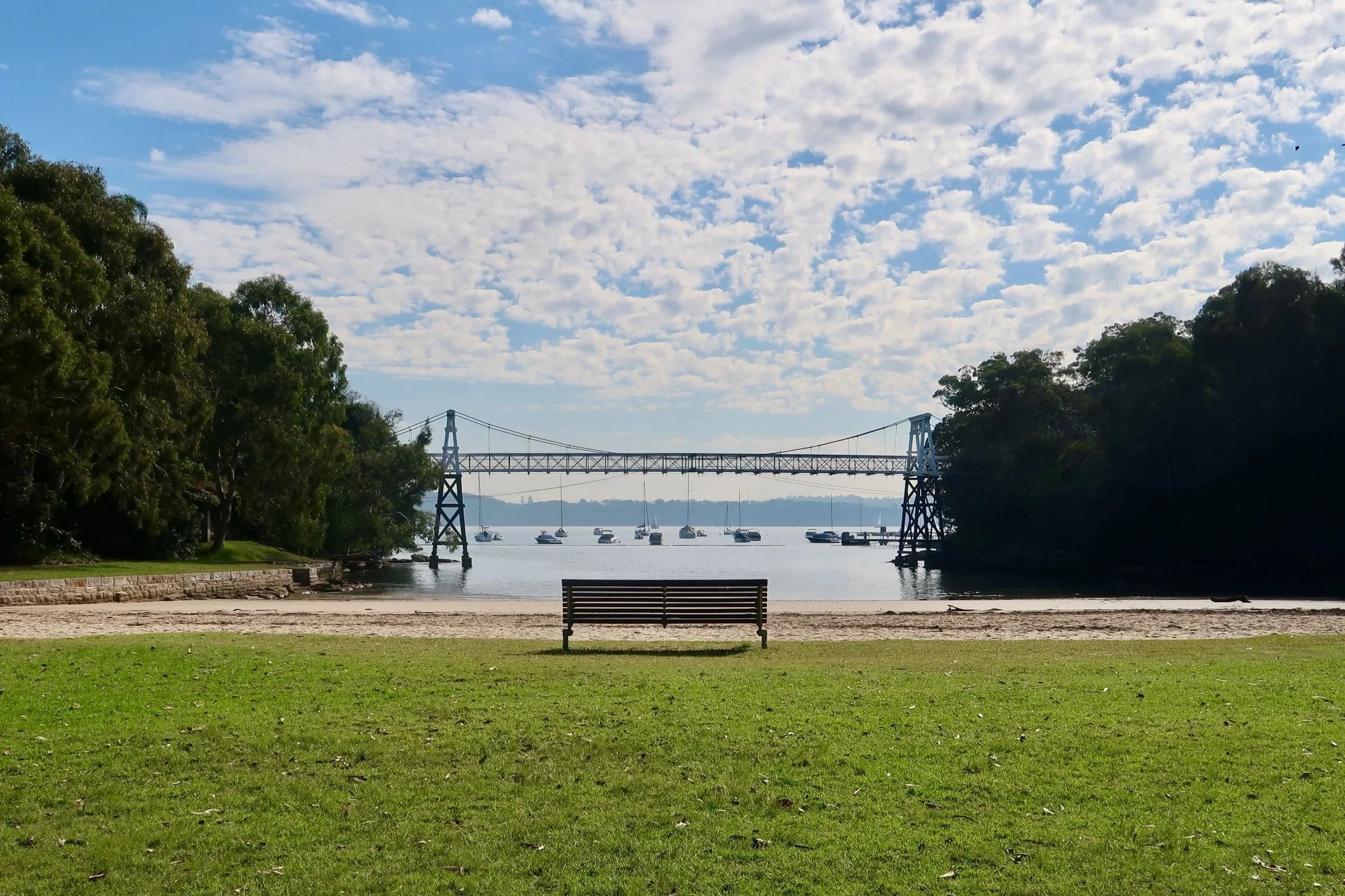
Parsley Bay Reserve
Parsley Bay Reserve is a very special spot and perhaps my favourite on this walk. While it is popular with families, it’s not nearly as crowded as nearby Neilson Park. There are toilets, a playground, and a little cafe. The sheltered beach is pristine and surrounded by beautiful bushland. Up on the headland there is also a short bushland circuit that takes you to a waterfall at the head of the gully.
After wondering around the reserve take the stairs back up as though returning to the bridge then turn inland to the path leading up to The Crescent. Not far now.
Follow The Crescent around to Hopetoun Avenue. From here, descend via Marine Parade to Gibson’s Beach and continue along the foreshore to Robertson Park, where the path opens out into Watsons Bay.
Watsons Bay is a lively and fitting end point. There are beaches, parks and plenty of places to eat — from fish and chips on the wharf to lively pubs and waterfront restaurants. From here, you can easily catch a ferry back to the city, or, if you still have energy, continue on towards The Gap, Camp Cove or South Head.


Final Thoughts
The Rose Bay to Watsons Bay walk is a wonderful way to experience Sydney Harbour at a slower pace, linking busy beaches with quieter bays and pockets of bushland. With frequent opportunities to swim, rest and explore, it’s a walk best enjoyed without rushing.
If you feel like extending the walk, the 3km Watsons Bay to South Head Trail is nearby. If you’re feeling very energetic the 9km walk between Watson’s Bay and Bondi is spectacular.
LAST UPDATED JANUARY 2026