Bennelong to Barangaroo
-
A scenic and history-rich harbour walk linking Bennelong Point, Circular Quay, The Rocks, Walsh Bay and Barangaroo.
Distance: 4 km
Time: 1–2 hours
Steps: 7,000
Level of difficulty: Easy -
Sydney Opera House and Bennelong Point
Circular Quay foreshore and harbour views
Sydney Writers Walk plaques
The Rocks historic precinct
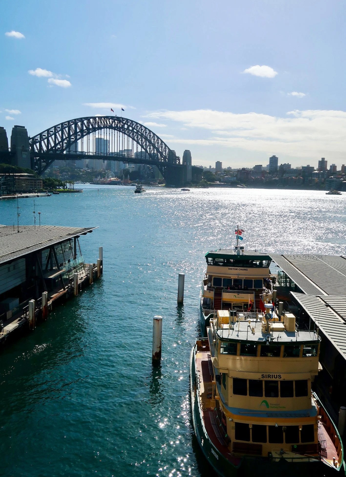
Dawes Point and Harbour Bridge views
Walsh Bay wharves and arts precinct
Barangaroo Reserve parkland and harbour swimming area
Barangaroo waterfront dining and ferry return
-
Fully paved and accessible paths throughout
Can be busy around Circular Quay and The Rocks, especially weekends
Plenty of food and café stops along the route
Ferry return available from Barangaroo Wharf
Easy to shorten or extend at multiple points
If you want to show off Sydney and impress visitors from out of town, this walk should be high on your list. It’s a scenic harbour-edge route with a good dose of history along the way, linking some of the city’s most recognisable landmarks.
Starting at Bennelong Point beside the Opera House, the walk follows the foreshore around Circular Quay, past The Rocks and under the Harbour Bridge to Walsh Bay and Barangaroo. It can take less than an hour or several hours, depending on how many stops you make — and there are plenty of diversions, from museums and historic sites to cafés, restaurants and harbour viewpoints.

BENNELONG TO BARANGAROO WALK
Distance 4 km Steps 7000
Time 1-2 hours Level of Difficulty Easy
Bennelong & Barangaroo
Bennelong was a Wangal man and one of the first to form close relations with the British settlers. He was captured along with another man called Colebee in November 1789, as part of Governor Arthur Phillip’s plan to improve relations with the locals. (That’s one way to do it!)
Bennelong and Phillip established a working relationship, with Bennelong assisting the governor by teaching the colonisers about Aboriginal customs and language. He in turn learned some English, adopted many European customs and manners of dress and even travelled to England in 1792 and was presented to King George in 1793.


Barangaroo, a member of the Cammeraygal clan, was Bennelong’s second wife and he, her second husband. Barangaroo’s first husband and two children were killed by the smallpox epidemic which decimated the Aboriginal people killing an estimated 80% of the population.
Barangaroo is said to have been a strong, forthright woman. Like most Eora women, she would have been the main provider for her family, daily fishing the local waters in a bark canoe.
Barangaroo was introduced to the British by Bennelong in 1790 but apparently wasn’t a fan. Indeed, she refused to be influenced by the trappings of European dress and alcohol and openly chastised her husband for taking up both.
Barangaroo is the first significant location to be named after an Aboriginal woman.
WALKING THE TRAIL
Bennelong Point & the Opera House
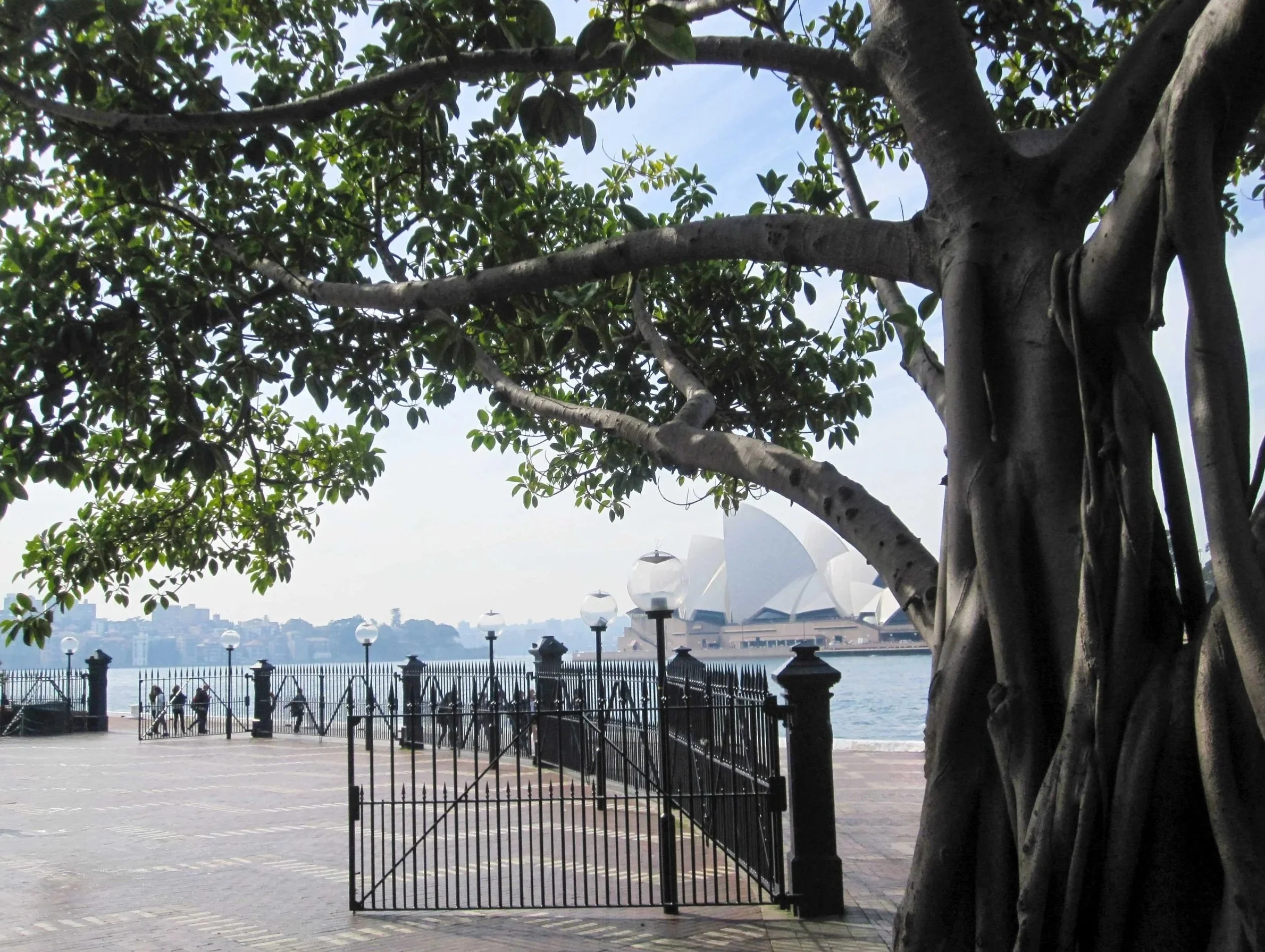
The walk begins at the Opera House, on Bennelong Point, once a small tidal island. Bennelong himself lived here in a brick hut, giving the point its name. It’s had many other names, according to its use, including Cattle Point, Battery Point and Fort Macquarie. The Cadigal people know it as Tubowgule.
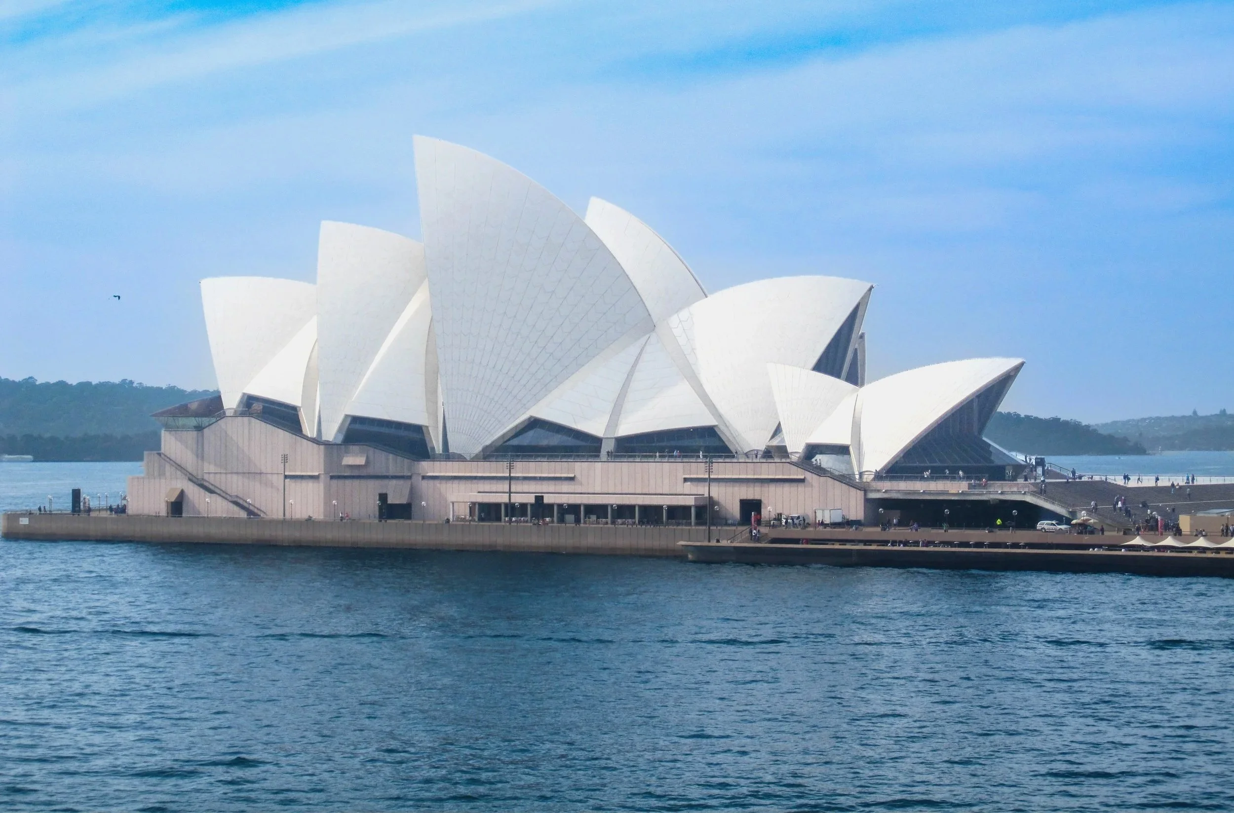
The Sydney Opera House sits on Bennelong point
It’s little wonder that the Opera House is one of the twentieth century’s most celebrated structures. Over one million tiles make up the 4,228 tile chevrons of its vaulted shells, which sit like billowing sails on the edge of Bennelong Point.
The Opera House was designed by Danish architect, Jørn Utzon, his design being chosen from many in an open competition in 1956. If you’re interested in the history, The Lucky Accident of Sydney's Opera House tells the story of the design, as well as the scandals, tragedies, and political wrangling involved in getting the project done.
Take the time to walk up, down and around the building as far as you can, to get a sense of the scale and view from different angles. And head down to the Northern VIP steps facing the harbour and you might catch a glimpse of Benny the Seal. For at least part of the year, Benny (or one of his friends) camps out on these steps.


The Opera House hosts everything from drama to dance, kids concerts, rock concerts, symphonies and of course, opera. Check what’s on or book a tour to find out more about this unique UNESCO World Heritage listed building.


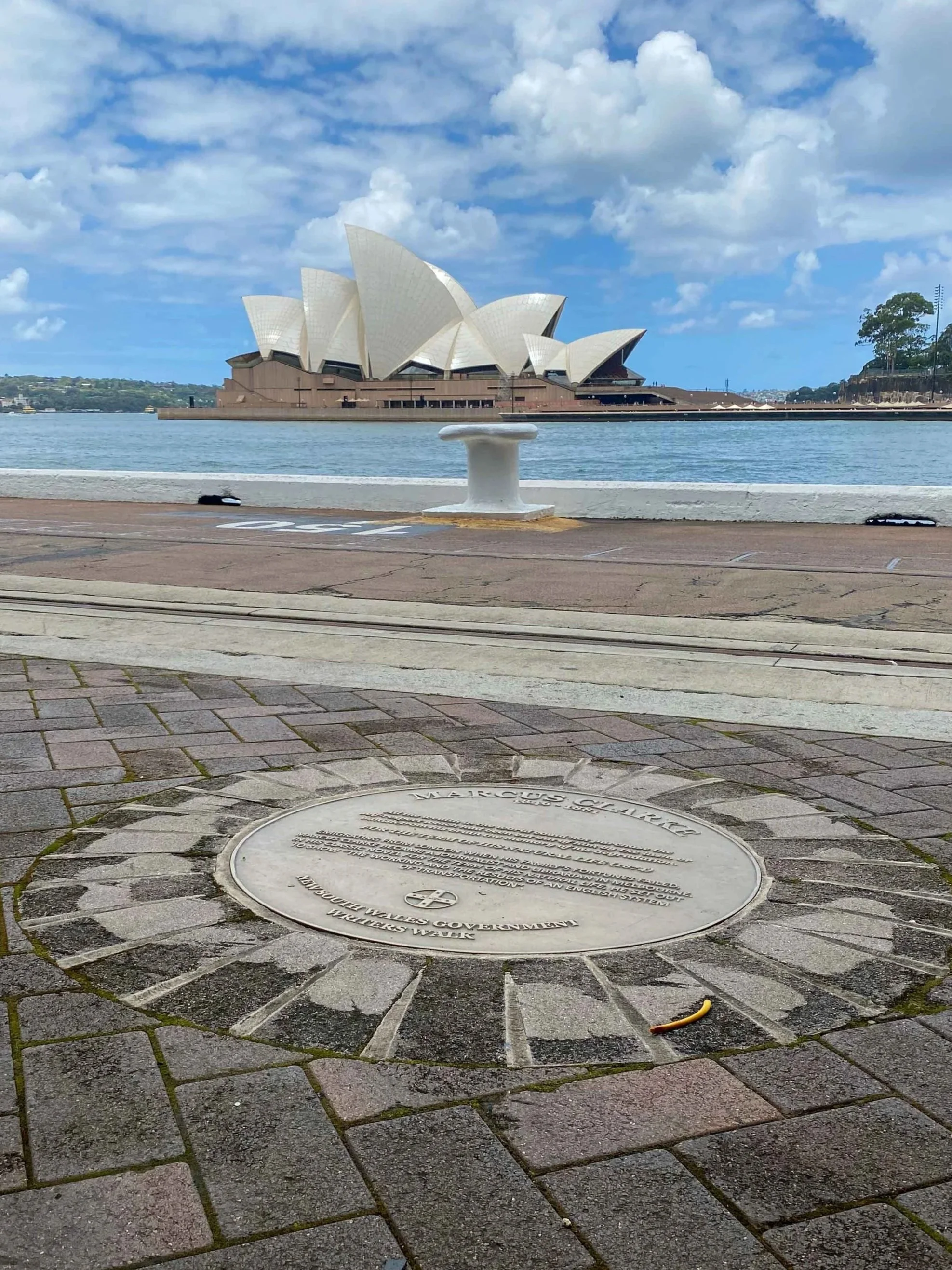
Leaving the Opera House forecourt, walk back toward Circular Quay along the waterfront. As you go, look down — underfoot are markers showing former shoreline positions from 1788 onward, tracing how land was reclaimed to create the quay.
Also set into the paving along this stretch is the Sydney Writers Walk: a series of circular metal plaques. The plaques honour the lives and works of renowned Australian novelists, poets and historians - Judith Wright, Peter Carey and Marcus Clarke to name a few, as well as notable visitors from abroad, including Mark Twain and D.H. Lawrence. Stamped onto each plaque are excerpts from well-known works as well as biographical information. It’s an intriguing diversion as you make your way around the quay.
Circular Quay foreshore
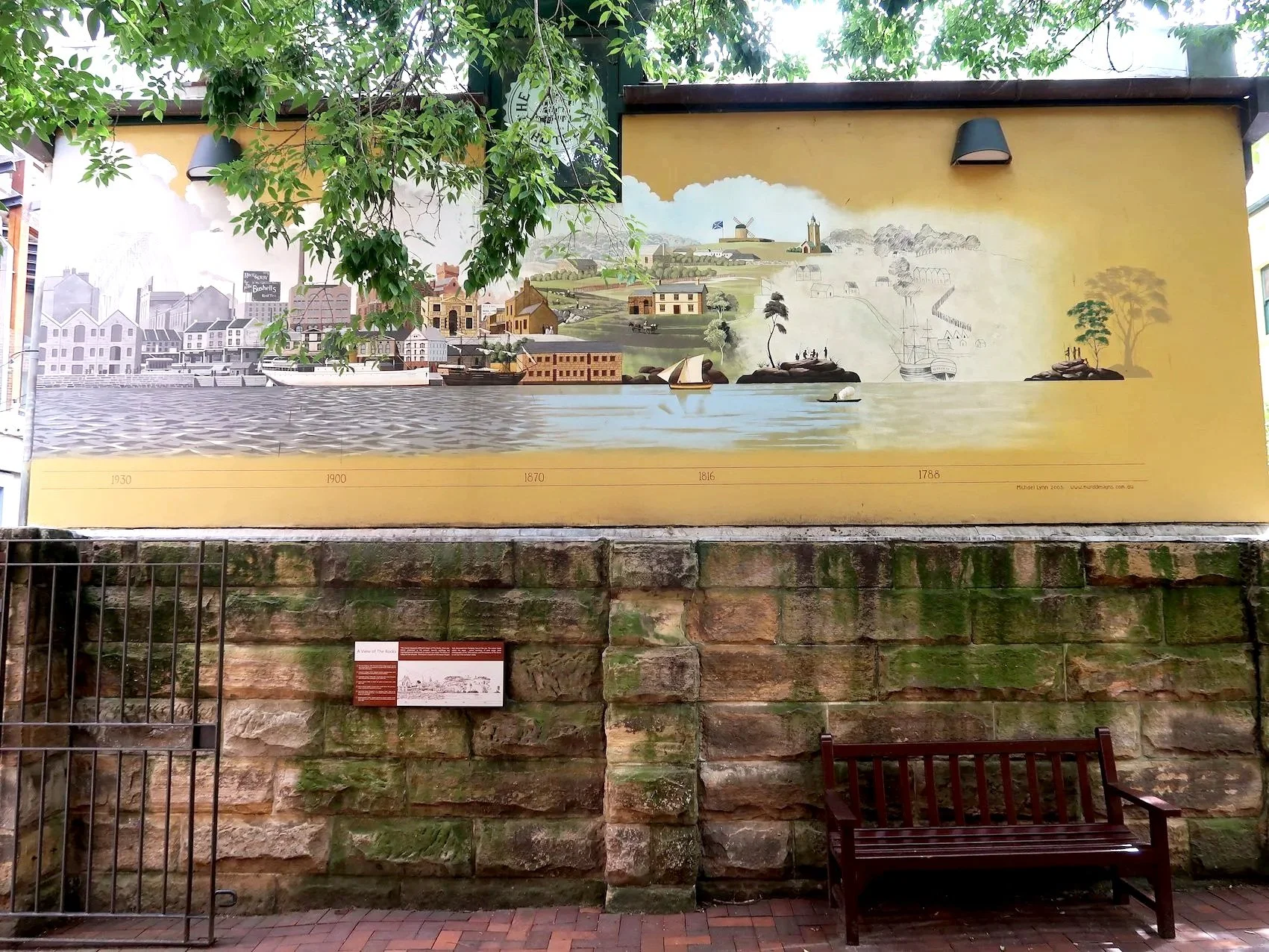
A lot has changed since the British first landed here in 1788, much to the surprise of the locals. They quickly made their mark on the land, first setting up campsites and then buildings on the western shore of Sydney Cove and what we now call Circular Quay.
The artificial shoreline that formed Circular Quay (or Semi-Circular Quay, as it was first known) was constructed in the 1830s–40s. It initially served as the colony’s main port before ferrying passengers became its primary function. The first ferry wharf opened here in 1879, and a harbour ferry network soon formed with the Quay as its hub. Today it remains one of Sydney’s main transport centres, linking ferries, trains and buses.

Circular Quay, 1892 Arthur Streeton
The Rocks & Campbells Cove
The path from the Quay curves around the water with the Museum of Contemporary Art on your left. We’re going to keep going on past the MCA to Campbells Cove but it’s worth noting that the MCA is efinitely worth a visit. So too is The Rocks, or Tallawoladah, which preserves much of Sydney’s earliest colonial footprint, with laneways, terraces and remnants of the original settlement.
Sydney, old and new in The Rocks

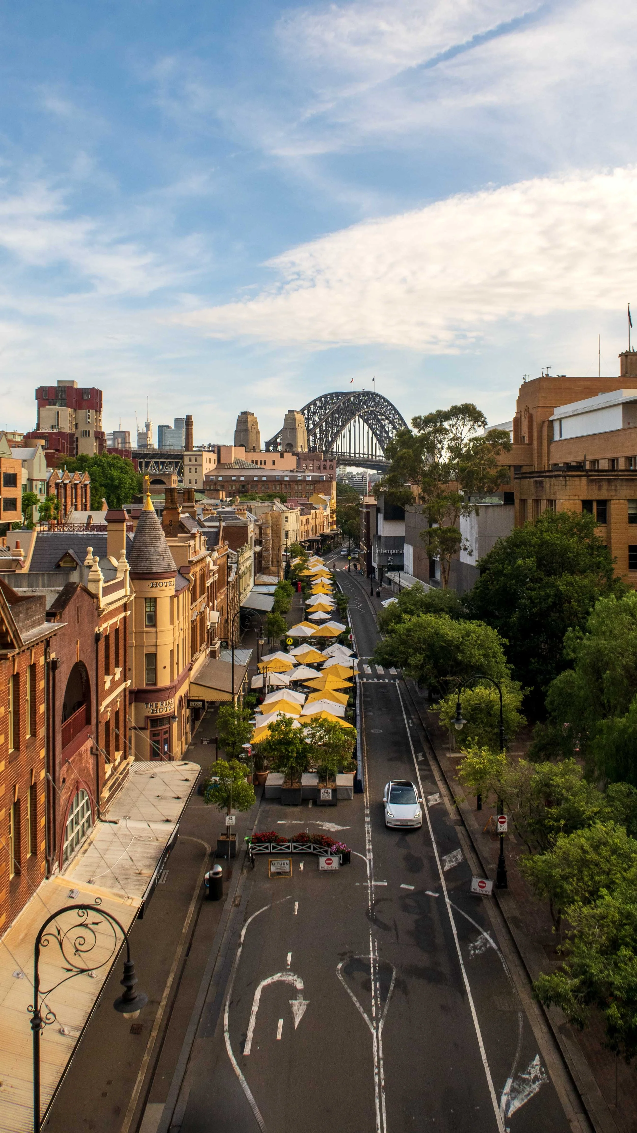
Once a rough waterfront district of sailors, pubs and gangs — and the site of the 1900 plague outbreak — it is now a major visitor precinct. Cadmans Cottage beside the MCA is one of Sydney’s oldest surviving buildings, and the nearby Lord Nelson and Fortune of War both claim to be the city’s oldest pub.
The Rocks is a walk in itself, especially when markets fill the streets on weekends. For now, skirt around Campbells Cove and continue toward Dawes Point.
Campbell’s Cove
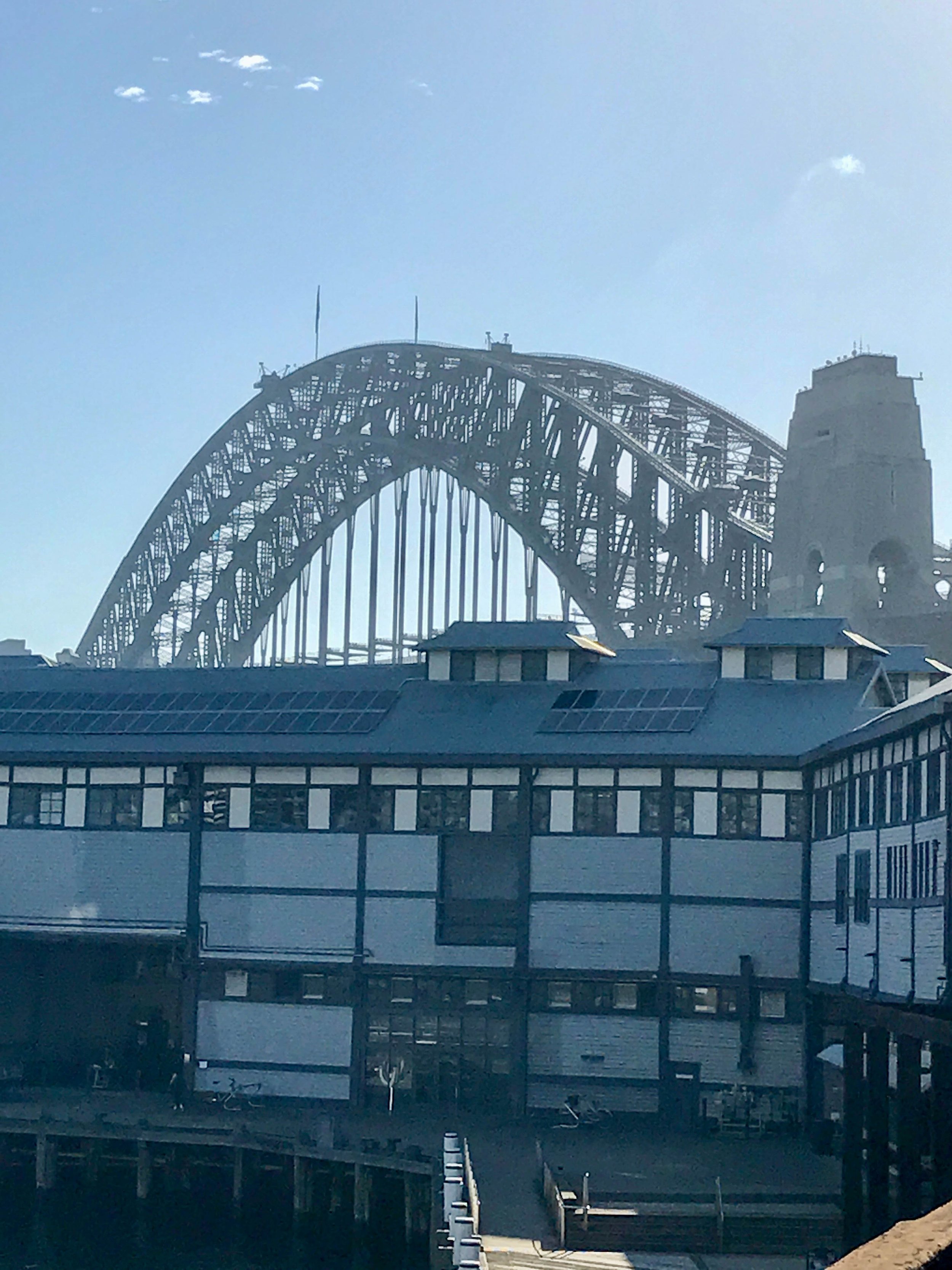
Dawes Point & the Harbour Bridge
Dawes Point now sits in the shadow of the Harbour Bridge but Sydney’s first observatory once stood here. The observatory was established by William Dawes who came out on the First Fleet as the colony’s first astronomer, though he also served as engineer, botanist, and surveyor.
Dawes is a bit of a legend really and writer Kate Grenville is clearly a fan. Her story The Lieutenant is basically a romantic retelling of Dawes’ actions and interactions in the new colony. Her more recent novel, A Room Made of Leaves is set at this very point and pairs Dawes romantically with another legendary figure of Australian history, Elizabeth Macarthur. How much of the story is history and how much fantasy is certainly open to question, but it’s a good story.
Remnants of the colony’s first battery remain on the hill, where guns were mounted in 1788.


Walking around the point you’ll approach the wharves of Walsh Bay (and this sculpture) ahead.

'Still Life With Stone and Car', Jimmie Durham
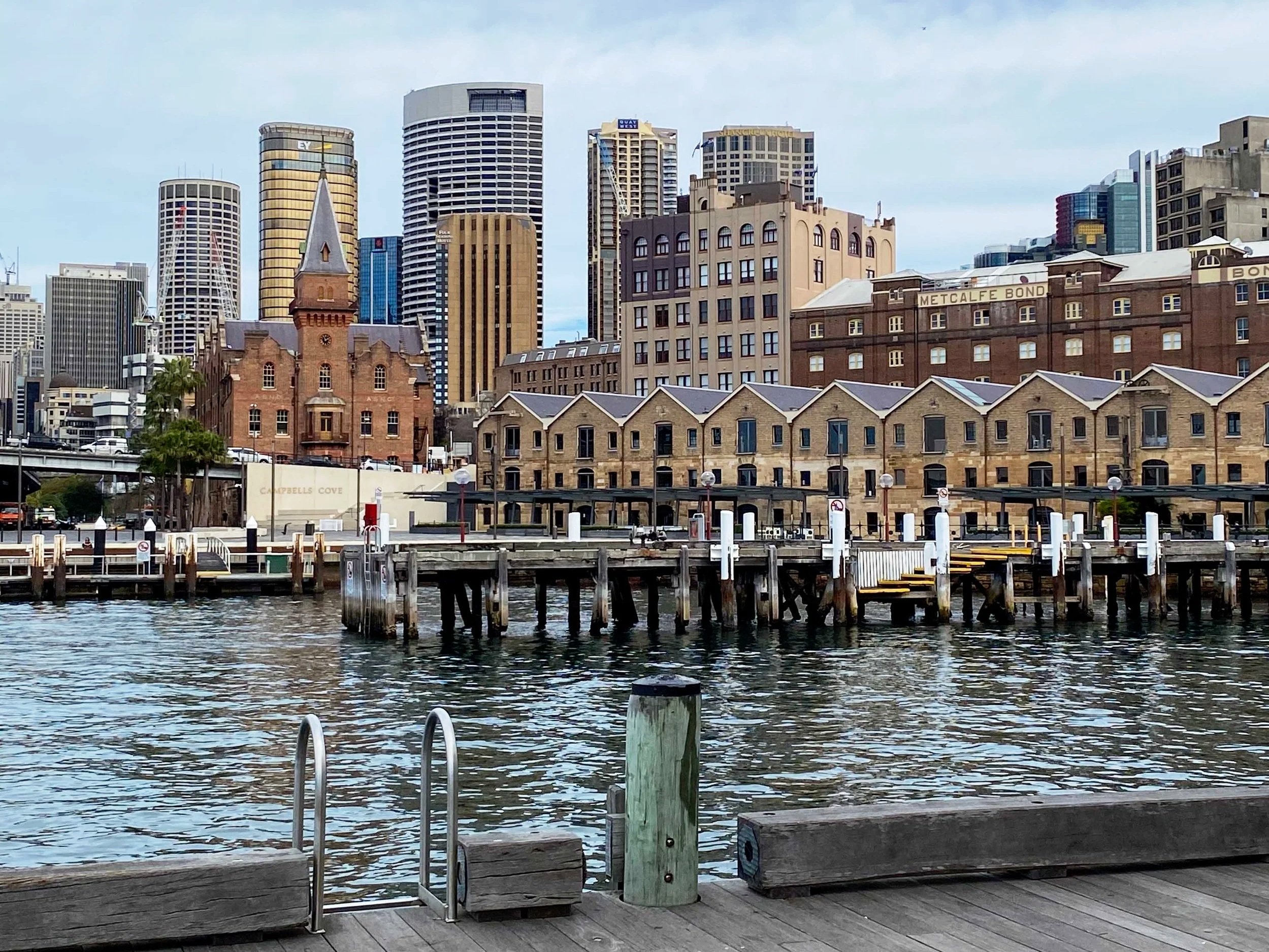
Walsh Bay
The wharves of Walsh Bay were constructed in the early 1900s and served as part of a working port. They were converted to apartments, theatres, and cafes in the nineties and various arts organisations began to take up residence from this time.
The area is now a real hub for the arts and was designated a Major Arts Precinct in 2015. It is home to Sydney’s premier arts companies including Bangarra Dance, Sydney Theatre Company, Sydney Dance Company and The Australian Chamber Orchestra.
This might be a good place to stop for coffee or a bite to eat. The area has a great vibe, enhanced no doubt by the presence of so much creativity and those charming old timber wharves, with the bridge as a backdrop.

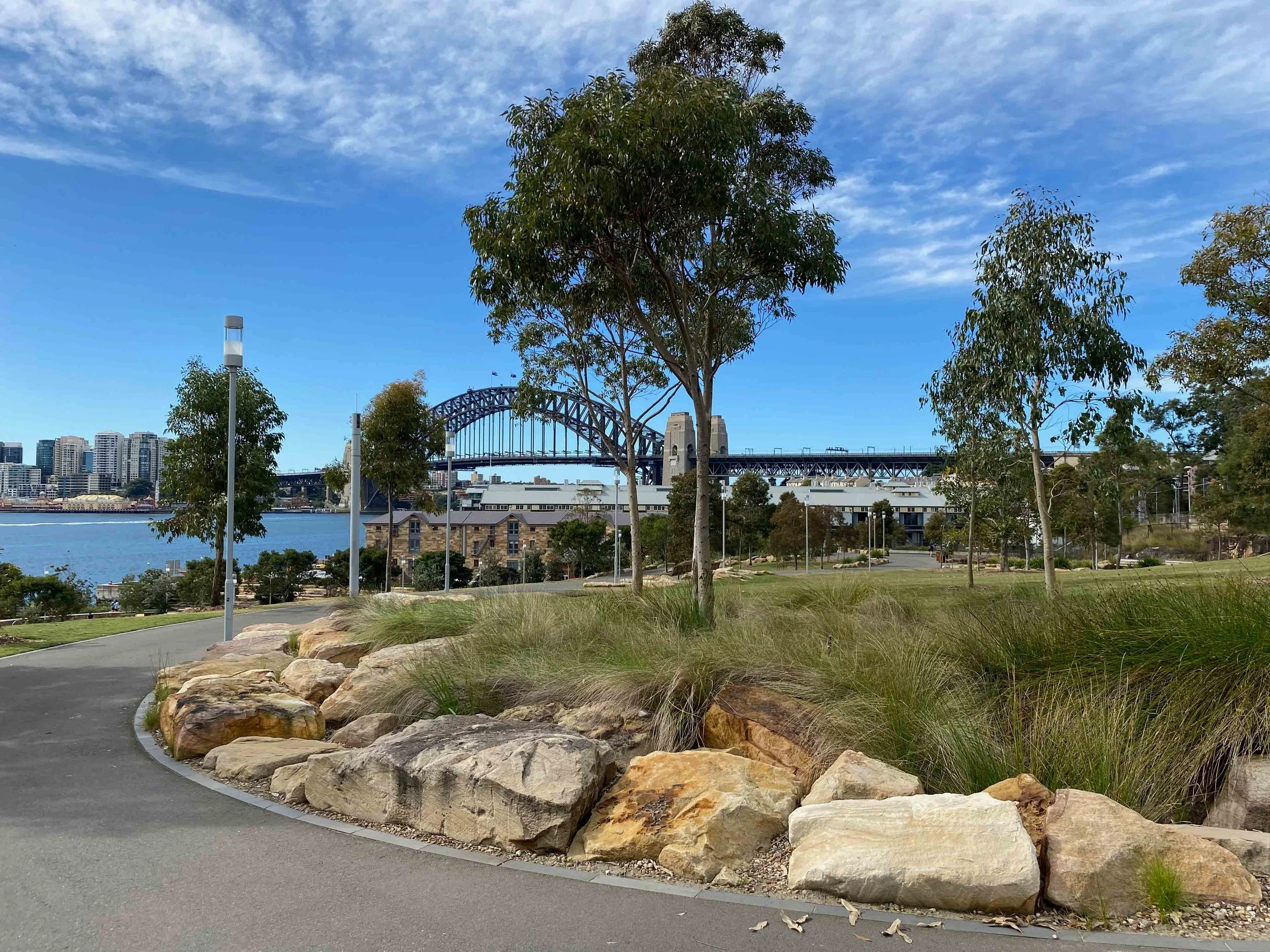
Barangaroo Reserve to Barangaroo waterfront
Leaving the wharves, walk to the end of Hickson Road and turn right to enter Barangaroo Reserve.
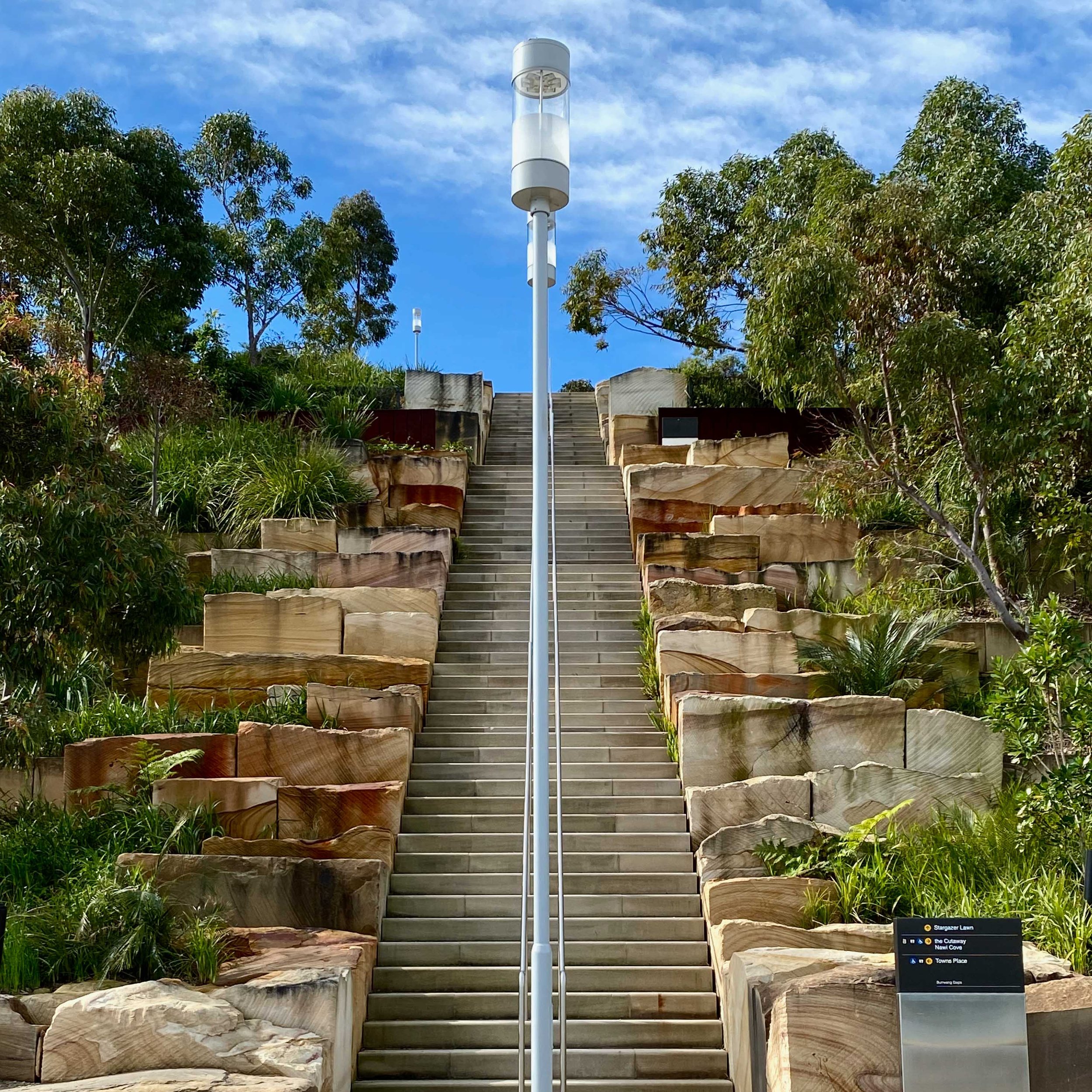
Opened in 2015, this six-hectare parkland occupies what was once industrial waterfront and, long before that, a gathering place for Aboriginal women. It is now a multi-levelled, multi-purpose public space attracting walkers, joggers, cyclists and even swimmers, with a dedicated swimming area opened in 2023.
Wide paths, sandstone terraces and native plantings create a multi-levelled harbour park with sweeping views. Paths and lifts make access easy for prams and wheelchairs.
Take time to wander through the terraces and lookouts before heading toward the northern exit. Near the Cutaway, the Wellama Welcome to Country installation plays continuously.*
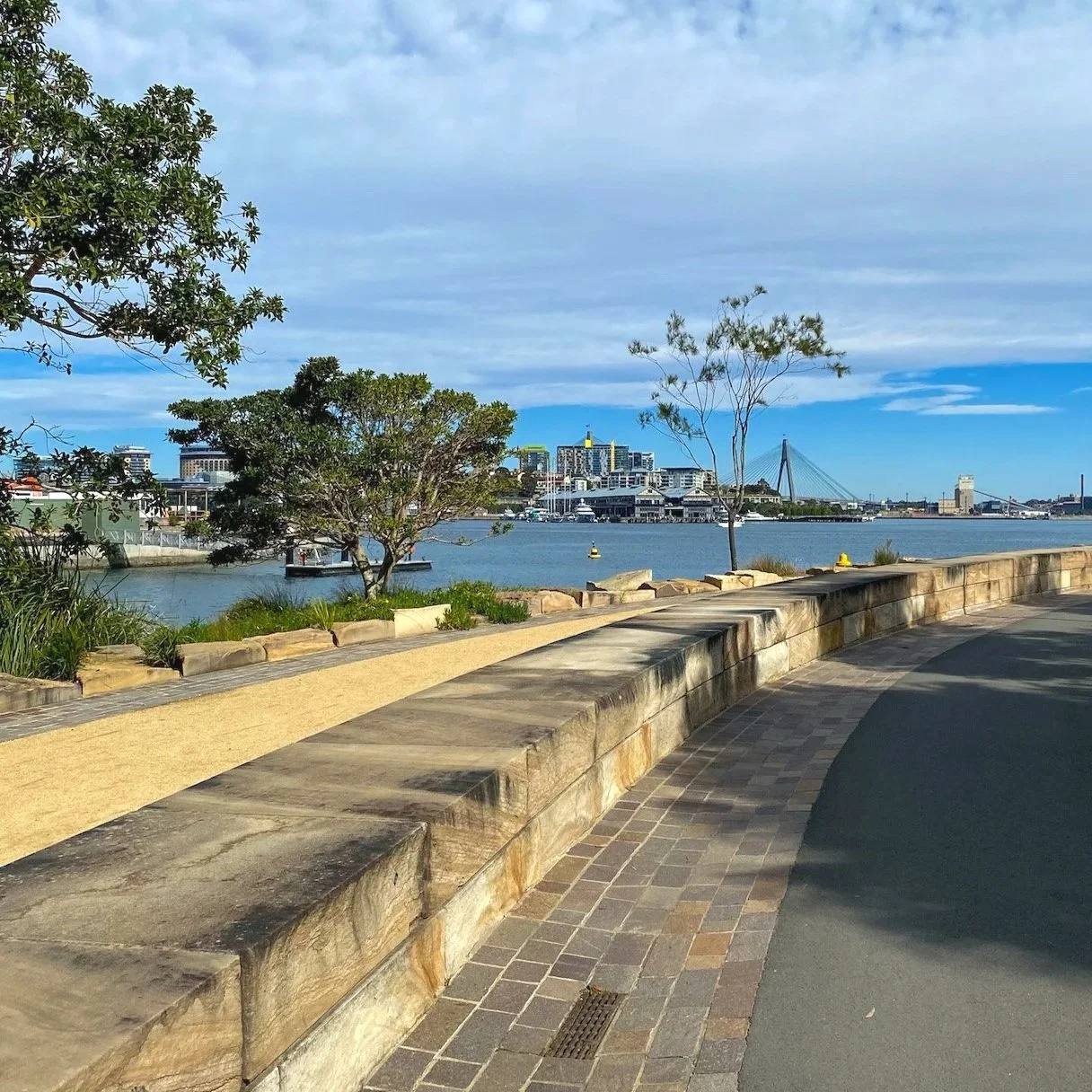
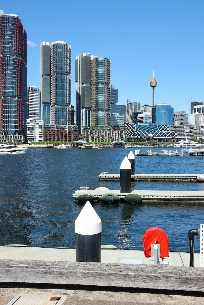
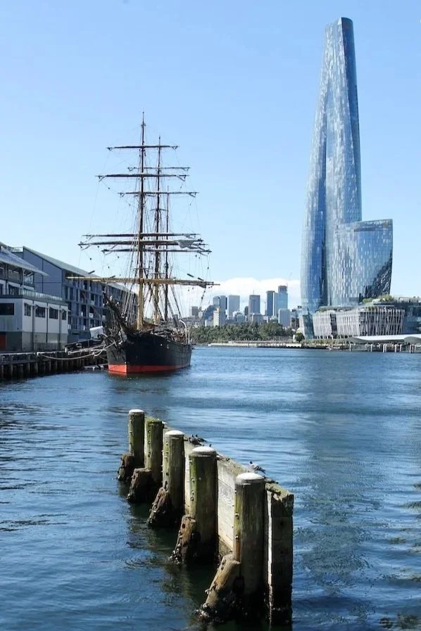
Beyond the reserve lies the commercial end of Barangaroo, parts still under construction but nearing completion. At the far end are offices, restaurants, cafés and retail spaces, along with the towering casino building. Elsewhere, the mix of architecture is more engaging — Barangaroo House on the waterfront, with its layered curves and cascading greenery, is a standout.
Barangaroo Wharf is here for the ferry back to Circular Quay. If you have time before departure, I recommend a stop at nearby Rivareno Gelato — the coffee flavour, scattered with chocolate shards, is delicious. For something more substantial, there are some great restaurants nearby including Anason (Turkish) and Lotus (mixed Asian).
You could easily combine this with a walk through The Rocks and up to Observatory Hill or extend it by continuing on from here to Darling Harbour and Pyrmont.
*At time of writing, the Cutaway was undergoing a major renovation
LAST UPDATED FEBRUARY 2026