Wattamolla to Eagle Rock
-
A rewarding coastal walk in Royal National Park linking Wattamolla lagoon and beach with the dramatic clifftop lookout at Eagle Rock.
Distance 9 km Time 2-3 hours
Steps c14, 000
Level of Difficulty Easy/Moderate -
Wattamolla Beach and lagoon - calm swimming, snorkelling and picnic area
Stunning ocean views
Eagle Rock
Curracurrong Falls
Abundant wildlife and seasonal wildflowers
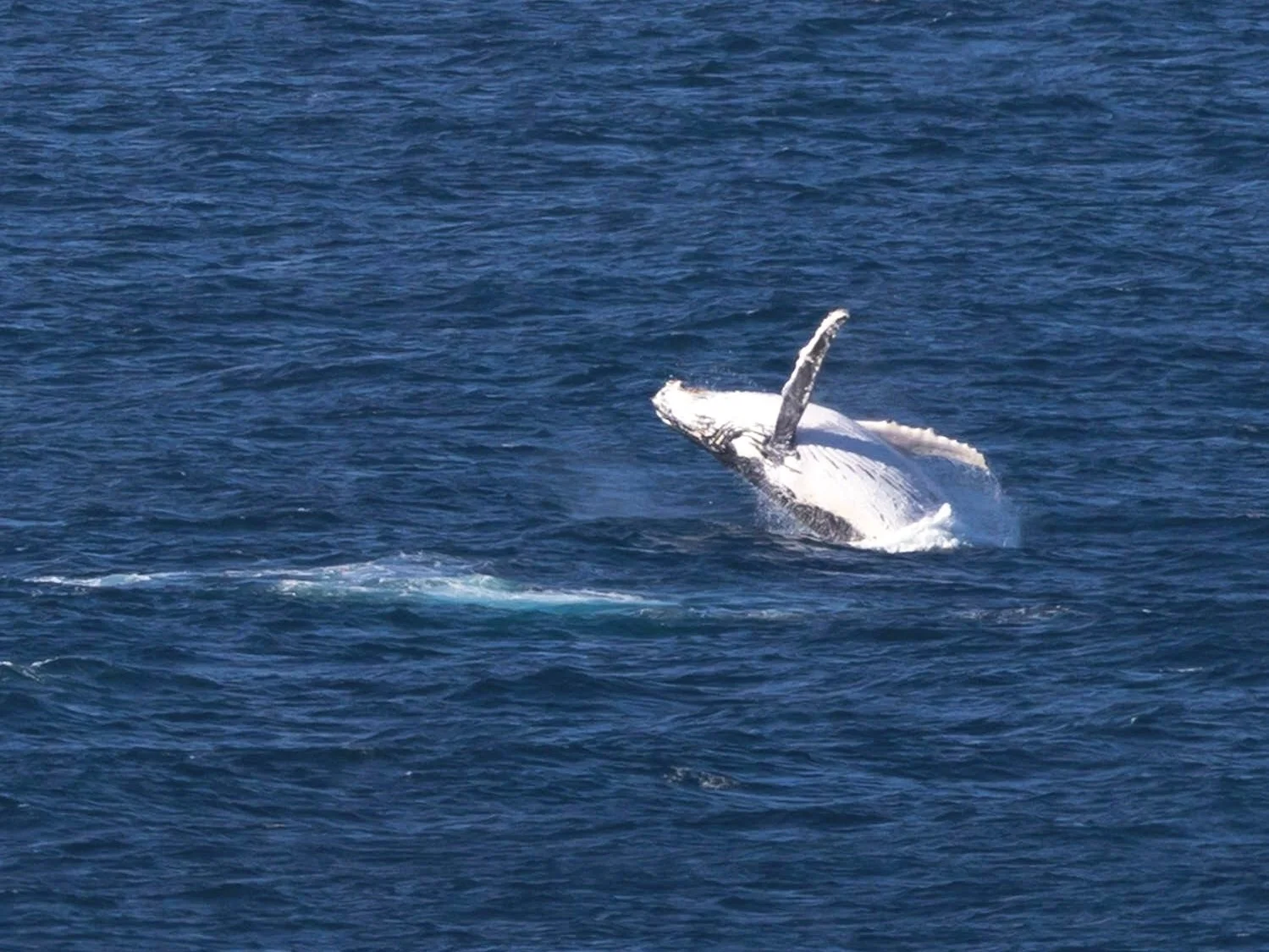
Providential Point and other clifftop areas are great for whale-watching (May-October)
-
Check National Parks website for information on closures before heading out
National Park entry fees apply
Go early to avoid the crowds (especially on weekends)
Take advantage of the toilets near the car park because they’re the only ones on the trail
Bring plenty of water as there are no potable water sources anywhere near the trail.
Pack a picnic for mid or post-walk
Hiking boots or sturdy shoes are recommended as you may find yourself scrambling over potentially slippery rocks.
Pack layers and a waterproof jacket as the weather can change quickly
Mobile phone reception is patchy so download map before you head out
Best whale-watching months are June–November
Don’t forget your camera!
Nestled within the Royal National Park south of Sydney, this walk from Wattamolla Beach to Eagle Rock is without doubt one of the most rewarding coastal hiking experiences in Sydney. And when I say hike, it’s more of a walk really with just a few hilly bits to keep you on your toes.
The trail features dramatic cliff-top views, pristine beaches and a variety of native flora and fauna. And if you’re here at the right time, you might be lucky as we were, and see migrating whales breaching just off the cliffs. Don’t forget your camera!
Getting To Wattamolla
The walk begins at Wattamolla Beach. To get there from Sydney, take the Princes Highway (A1) south and follow signs to Royal National Park. Enter through the park's main entrance, then continue along Sir Bertram Stevens Drive for approximately 12 kilometres until you reach the Wattamolla picnic area. The parking areas at Wattamolla Beach can fill up quickly on weekends so I recommend an early start.
Public transport options are limited. You could get a train to Cronulla Station, then take a bus to the park entrance. but you’ll need to get a lift in from there because it’s a long way.
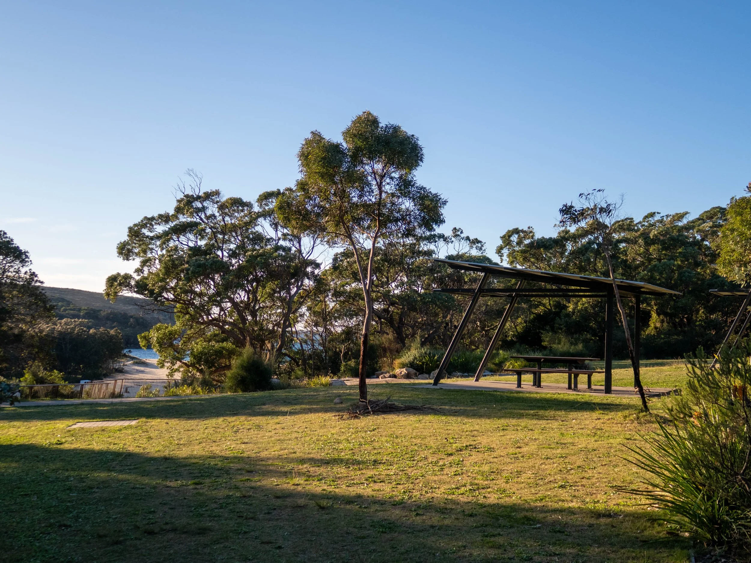
Walk starts from the car park and picnic ground near Wattamolla Beach
WALKING THE TRAIL
This Wattamolla to Eagle Rock trail is part of the 26km long Royal Coast Track which runs between Bundeena and Otford. Most people complete this extended walk over a couple of days, camping overnight. The Wattamolla to Eagle Rock section of the track is just 9 kilometres return and will only take 2-3 hours to complete, depending on your pace and photo stops.
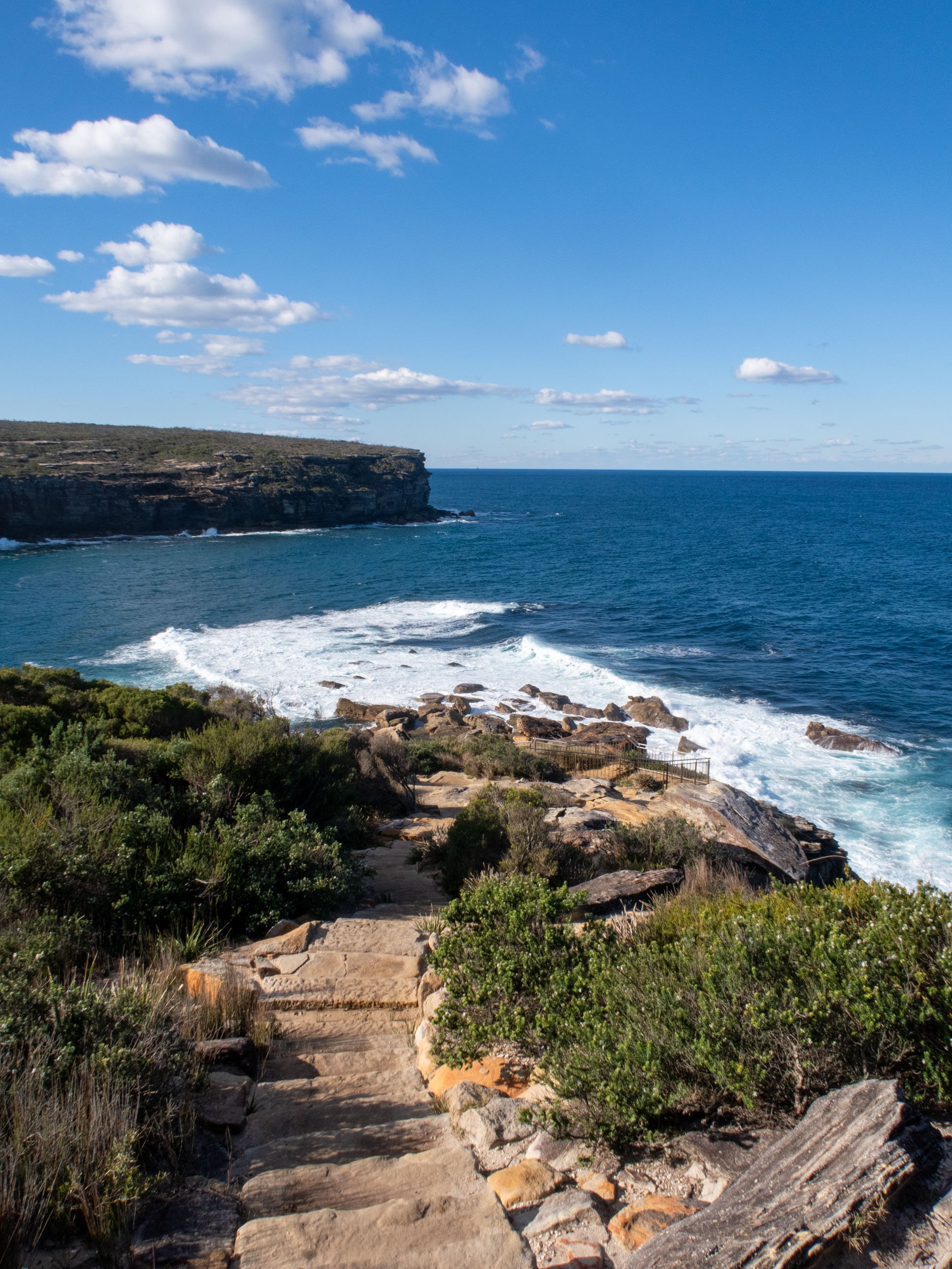
Wattamolla Beach to Providential Point
The calm lagoon, sandy beach and surrounding cliffs of Wattamolla Beach make a beautiful starting point. From the picnic ground, take the trail marked: Providential Point (or Coast Track South). Follow the track as it climbs gently through coastal bush before opening up to reveal the ocean and Wattamolla’s lagoon and beach on your left.
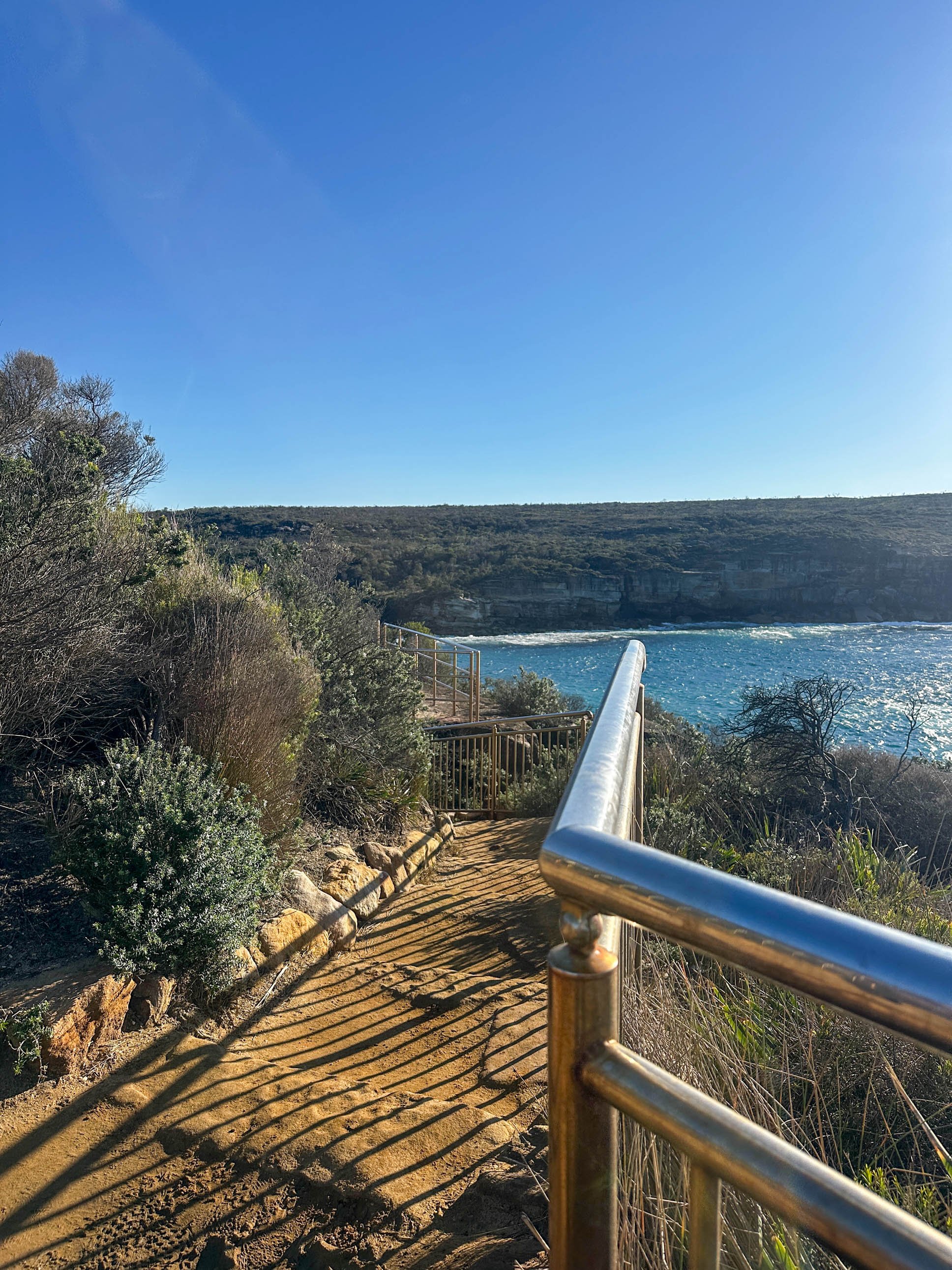
About 700 metres in you’ll reach Providential Point on the southern headland. It’s a good vantage point, popular with birders and a reliable whale-watching spot at the right time of year.

Providential Point - great spot for whale watching
Providential Point to Curracurrong Creek crossing
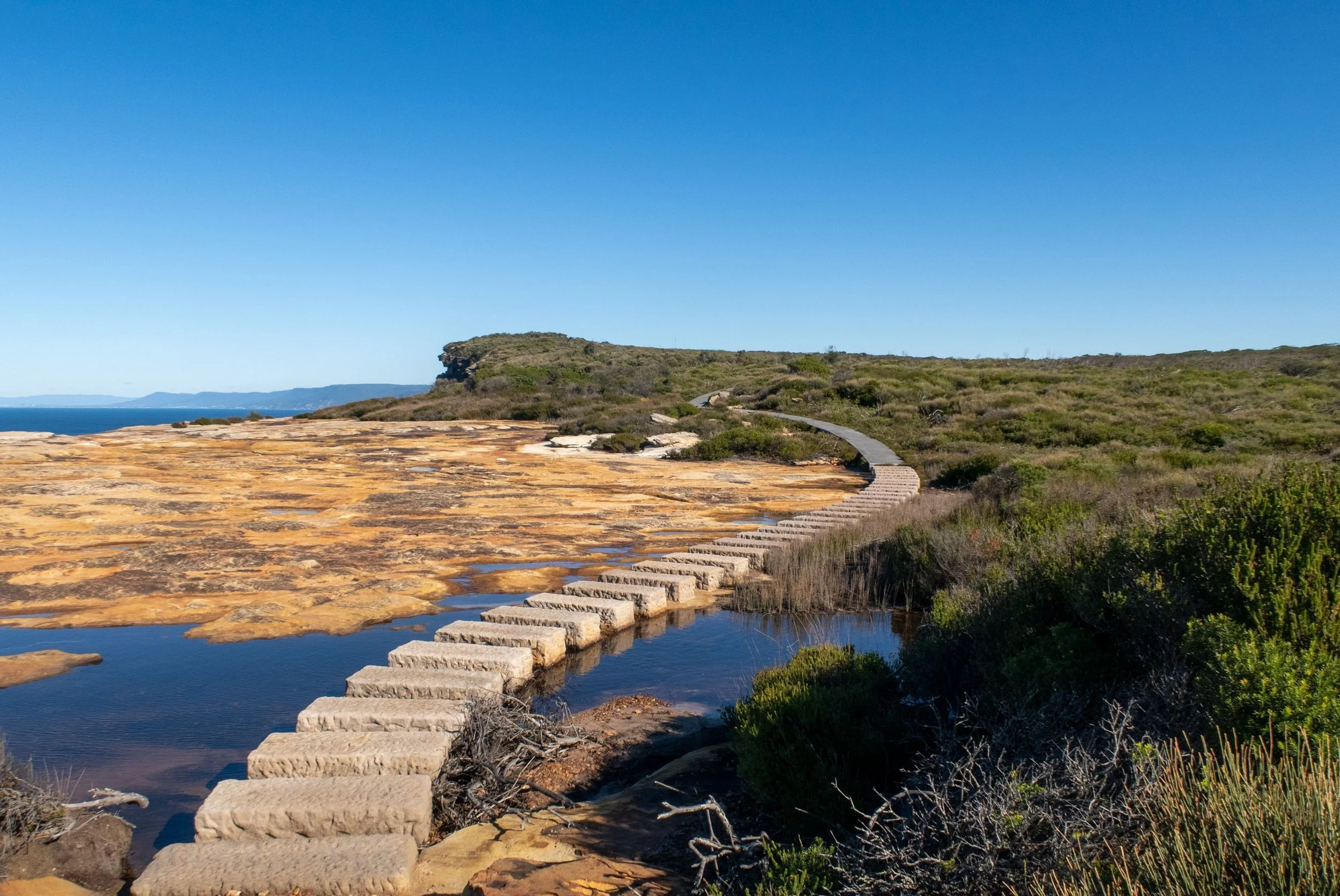
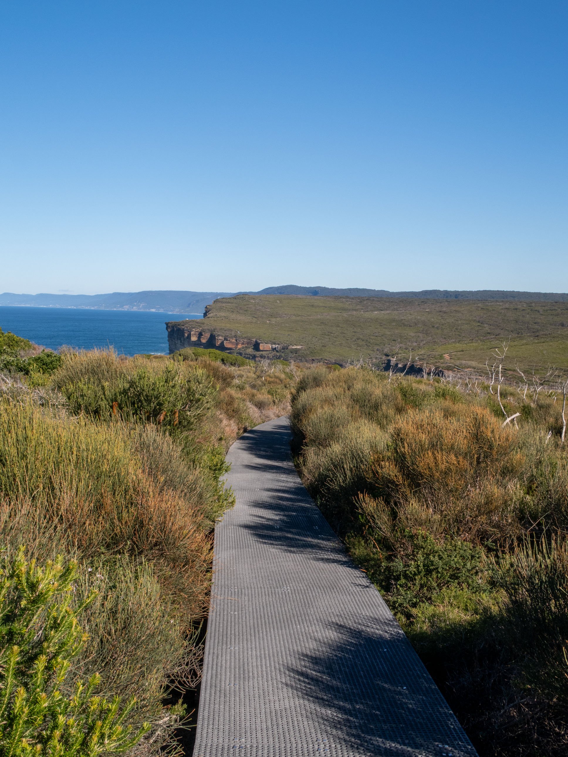
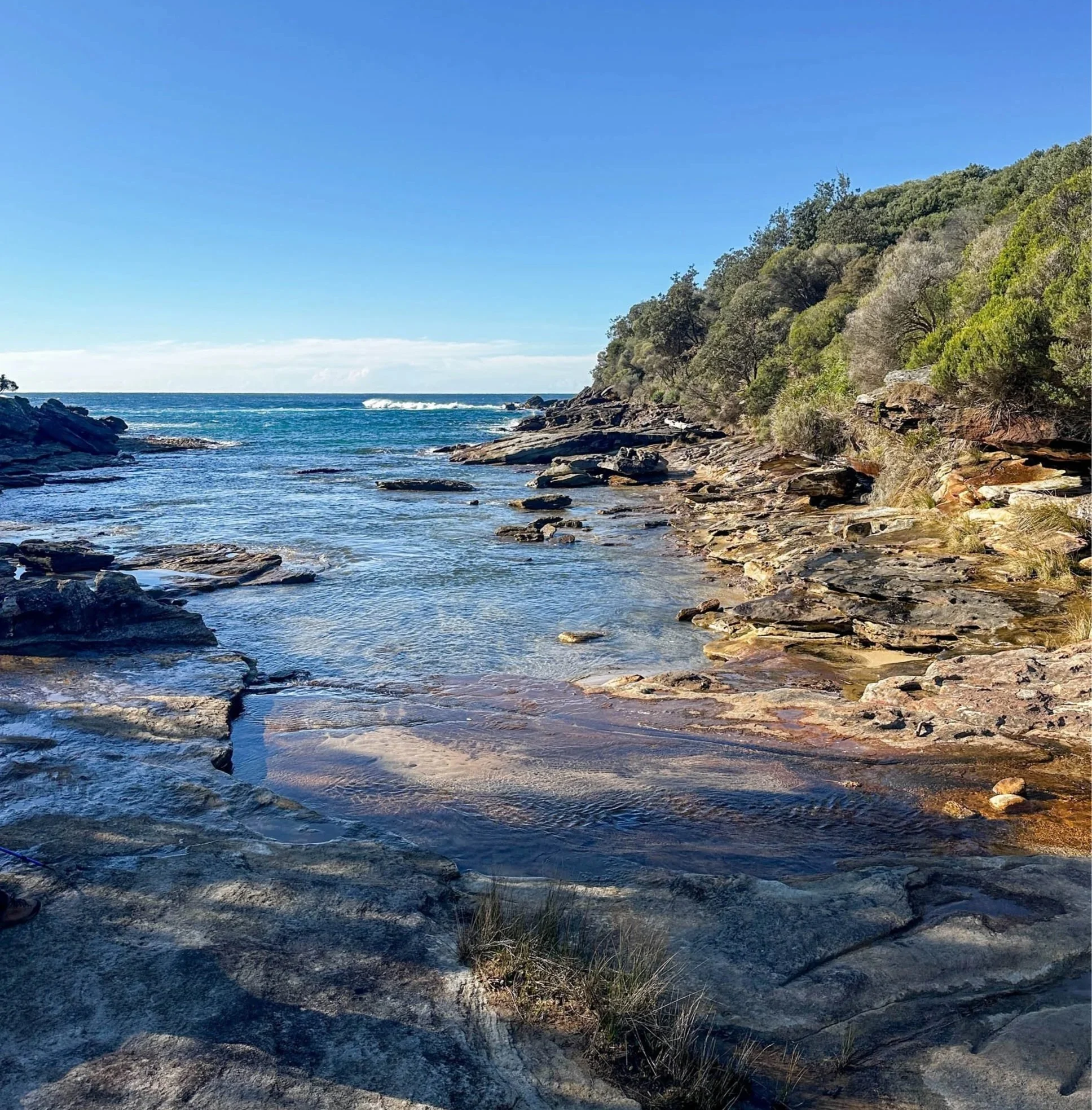
Beyond the lookout the track continues along the clifftop, with ocean panoramas to your left and dense heath to your right. Much of this section is on boardwalk, making for easy walking with long views along the coastline.
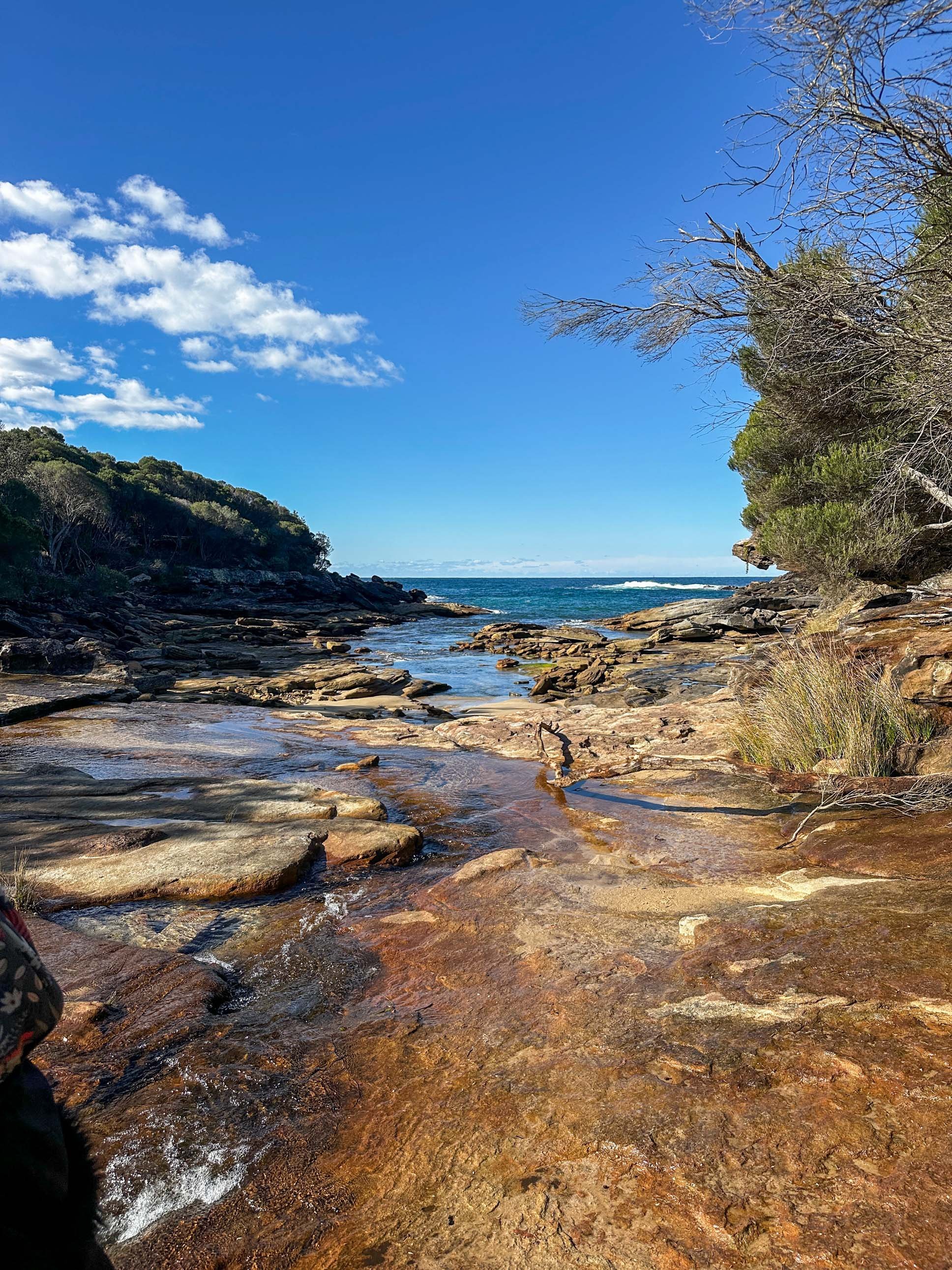
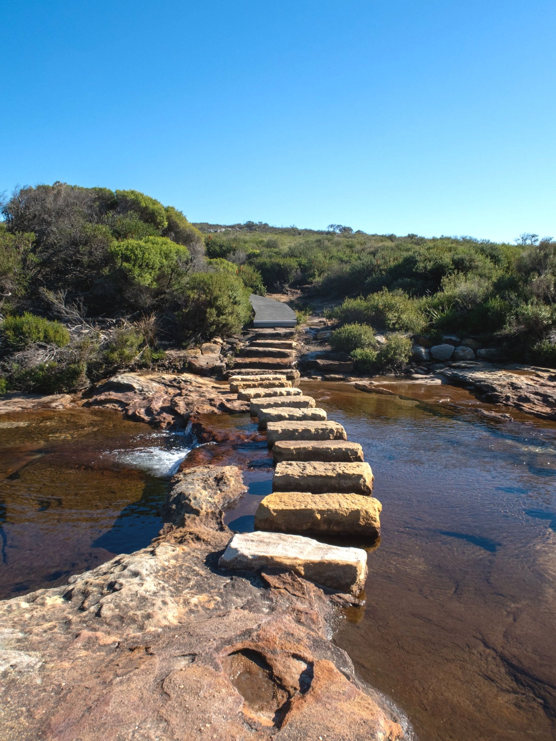
After about a kilometre the track drops to a small creek at Curracurrong Cove. Cross the stepping stones and continue on as the path begins to rise again.
Curracurrong Cove to Eagle Rock turn-off
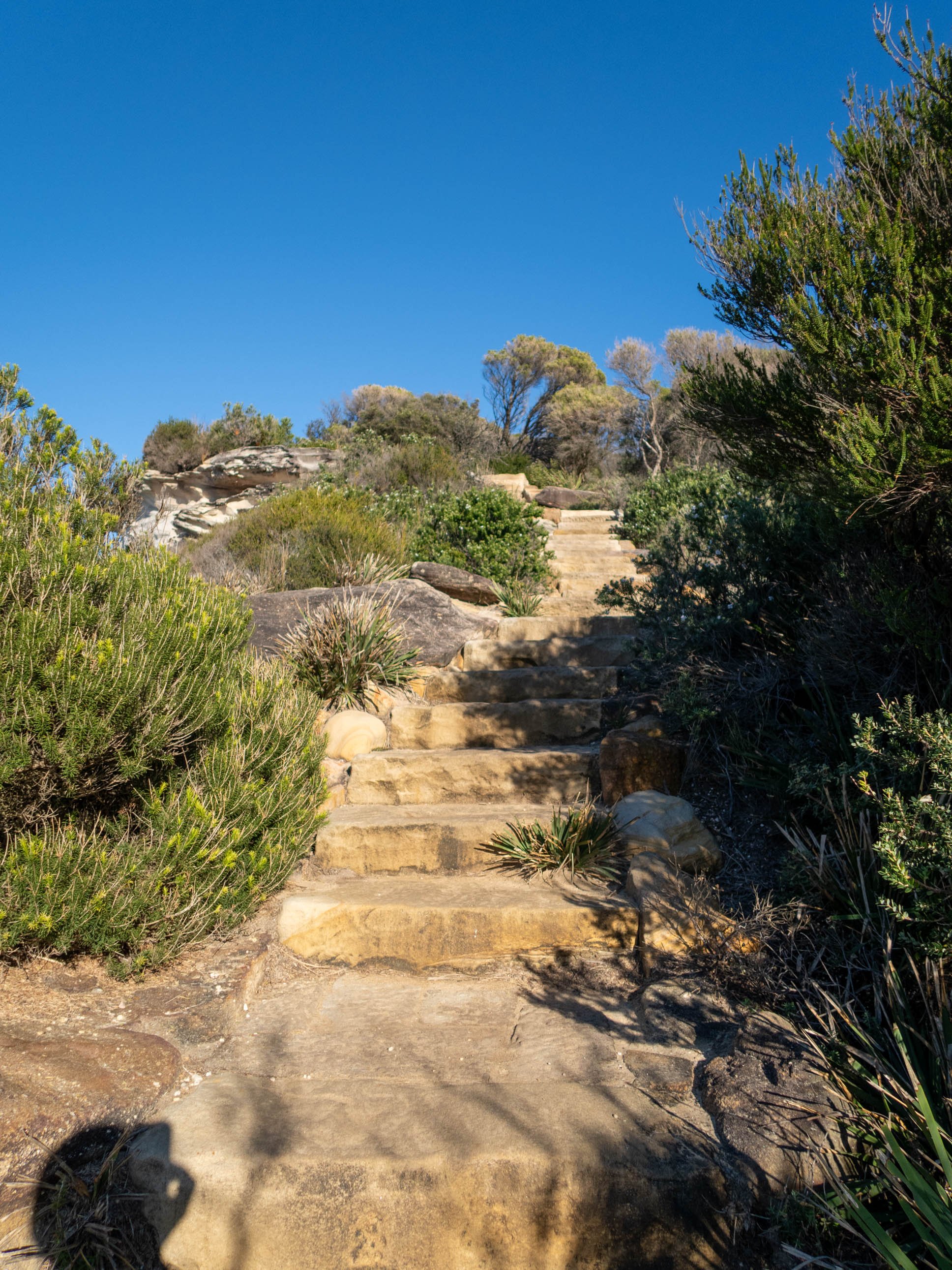
Climbing gradually away from the cove, the track alternates between natural rock and boardwalk. The vegetation is a bit thicker here with views more intermittent. You might notice more birdlife here as it is often active in this more sheltered section.
As the path levels out, a faint unmarked path branches off toward the sea. It’s about 150 metres long, unmarked and not all that obvious - we walked straight past it and had to double back.
The final approach to Eagle Rock also involves a short but steep scramble over rocks to reach the lookout point.
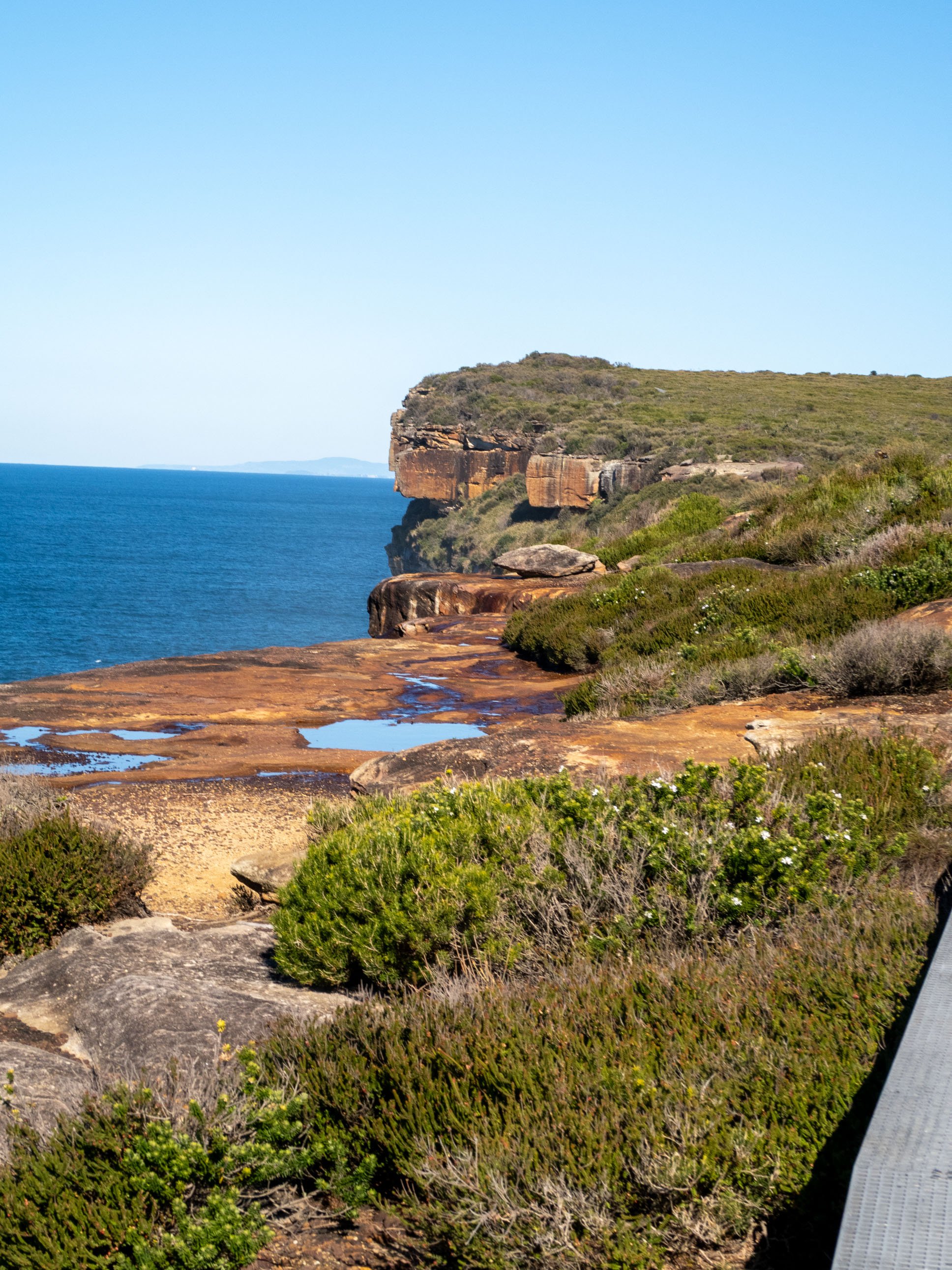
Eagle Rock and the falls
Eagle Rock is a sandstone outcrop that juts into the Pacific Ocean and is the star attraction on this walk. From the top of the rock you can see north toward Sydney on clear days, and south along the rugged coastline toward Wollongong. And if you’re lucky, you might see one of its namesakes, nesting or resting in the vicinity.

Eagle’s head viewed from the south
From Eagle Rock you can view the twin cascades of Curracurrong Falls whose spray you may have felt as you walked. They’re quite a sight to see from any angle, especially after rain, but Eagle Rock is the best place to watch them tumble side by side off the cliffs and into the ocean below.

Eagle Rock return to Wattamolla
Not quite done yet - head further south to look back at Eagle Rock, the bird’s head quite distinctive from this angle.
The return journey follows the same route, offering different perspectives of the spectacular coastal scenery you encountered on the way up. Back at Wattamolla, the lagoon and beach make an ideal place to cool off after the walk.
Wildlife
The Royal National Park is home to an impressive array of native Australian wildlife, and the area covered by the Wattamolla to Eagle Rock trail is widely heralded as one of the best places for spotting migrating whales (June to November). We walked in early June and saw heaps! We got very excited and the walk probably took us twice as long as it should have done because we kept stopping to watch them. One pod came in quite close to the rocks, escorted by a pod of dolphins, and we could even hear the whales calling to each other which was such a treat.


Birdwatchers too are attracted by the variety of species here. We saw rainbow lorikeets, kookaburras, wattlebirds, New Holland honeyeaters and silvereyes. We also spotted a wedge-tailed eagle heading would you believe, to Eagle Rock. There are many other birds to be found here, in the scrub or near the water. If you’re interested, the Birds of Providential Point self-guided walking tour is a useful resource from the NSW National Parks and Wildlife Service that will tell you more.
History
This area holds deep significance for Aboriginal people, particularly the Dharawal people. Eagle Rock and the surrounding coastline were important sites for fishing, gathering, and ceremony. Archaeological evidence suggests continuous Aboriginal occupation of the Royal National Park area for many thousands of years and rock engravings, shell middens, and rock shelters have been found in many areas of the park.
European settlement brought significant changes. The first recording of the British encountering the area was when explorers Bass and Flinders took refuge in Providential Cove in 1796. In 1879 the area was designated as a National Park, making it the world's second-oldest national park after Yellowstone. The ‘Royal’ was added after Queen Elizabeth II passed by in a train during her 1954 tour.
During World War II, the coastline here was monitored for enemy activity, and remnants of this wartime period can still be found throughout the park, though not specifically along this particular trail.

Bass and Flinders sought refuge in the cove in 1796. A memorial was erected in 1938 in memory of this event.
In the Area
Royal National Park has many other excellent walks, from short waterfall tracks to longer Coast Track sections. The NSW National Parks website is the best place to find one to suit. They also have information on camping, picnic areas and guided tours.
Cronulla is about a twenty minute drive from the entry to the park. The Cronulla Loop Track is a great way to explore the many beaches, reserves and parklands in the area and to soak up the local surf culture.
A little further on in the Kamay Botany Bay National Park is the Cape Baily Track, another great clifftop walk with fabulous views and, at the right time, whales aplenty.